


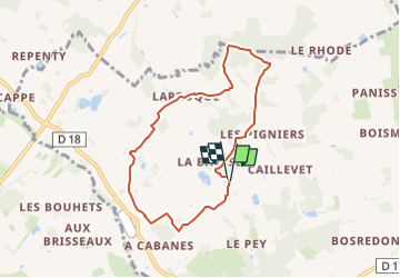
Thénac-Le Refuge

JMCMoreau
User

Length
7.1 km

Max alt
183 m

Uphill gradient
157 m
Km-Effort
9.2 km

Min alt
106 m

Downhill gradient
160 m
Boucle
Yes
Creation date :
2023-03-23 18:16:26.821
Updated on :
2023-03-23 18:17:09.531
3h00
Difficulty : Easy

FREE GPS app for hiking
 SityTrail
IGN / Geographical institutes
SityTrail Plus
The world is yours!
About
Trail Walking of 7.1 km to be discovered at New Aquitaine, Dordogne, Thénac. This trail is proposed by JMCMoreau.
Positioning
Country:
France
Region :
New Aquitaine
Department/Province :
Dordogne
Municipality :
Thénac
Location:
Unknown
Start:(Dec)
Start:(UTM)
289549 ; 4958655 (31T) N.
Comments