


Col du Hundsruck depuis Thann

tiene
User
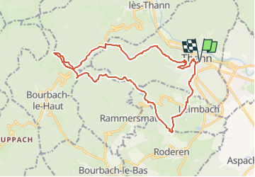

Length
18.2 km

Max alt
866 m

Uphill gradient
778 m
Km-Effort
29 km

Min alt
337 m

Downhill gradient
778 m
Boucle
Yes
Creation date :
2023-03-28 07:40:34.683
Updated on :
2023-03-28 07:47:20.846
6h29
Difficulty : Medium

FREE GPS app for hiking
 SityTrail
IGN / Geographical institutes
SityTrail Plus
The world is yours!
About
Trail Walking of 18.2 km to be discovered at Grand Est, Haut-Rhin, Thann. This trail is proposed by tiene.
Positioning
Country:
France
Region :
Grand Est
Department/Province :
Haut-Rhin
Municipality :
Thann
Location:
Unknown
Start:(Dec)
Start:(UTM)
358030 ; 5296804 (32T) N.
Comments