Trail Walking Vaugines - SityTrail - PF-Vaugines - Le Mourre Nègre à partir de Vaugines - Var - Photo

SityTrail - PF-Vaugines - Le Mourre Nègre à partir de Vaugines - Var

 MicDul
MicDul

User

© OpenStreetMap contributors
Length
Length
20 km
Max alt
Max alt
1122 m
Uphill gradient
Uphill gradient
862 m
Km-Effort
Km-Effort  
32 km
Min alt
Min alt
371 m
Downhill gradient
Downhill gradient
866 m
Boucle
Boucle
Yes
Creation date :
2023-03-28 08:33:57.717
Updated on :
2023-04-01 15:45:14.875

(1 Reviews)

Walking
Walking
7h14
Difficulty : Very difficult

Scan this QR Code to open this trail in the SityTrail application

FREE GPS app for hiking

Logo SityTrail SityTrail

IGN / Geographical institutes

Download SityTrail from the App Store Download SityTrail from Google Play

Logo SityTrail SityTrail World

The world is yours!

Download SityTrail from the App Store Download SityTrail from Google Play Download SityTrail on Huawei AppGallery

About

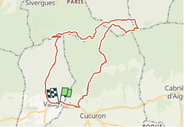
Trail Walking of 20 km to be discovered at Provence-Alpes-Côte d'Azur, Vaucluse, Vaugines. This trail is proposed by MicDul.

Description

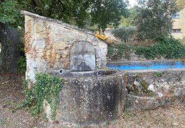
Départ du parking de Vaugines.
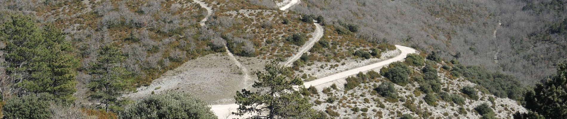
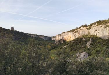
Ce grand circuit permet de découvrir deux des plus beaux vallons du flanc Sud, le Vallon de la Glacière et le Vallon de Vaunière, les crêtes et le point culminant du Grand Luberon, ainsi que le pittoresque village de Vaugines.

Elevation profile

Photos

Positioning

Country:
France
Region :
Provence-Alpes-Côte d'Azur
Department/Province :
Vaucluse
Municipality :
Vaugines
Location:
Unknown
Start:(UTM)
694481 ; 4850126 (31T) N.

Comments

Please log in to post a review or rate the element


Trails nearby

Trail Walking Cadenet - Cadenet -Lourmarin - Photo
Walking

Walking

Very easy
(1)
Cadenet, Provence-Alpes-Côte d'Azur, Vaucluse, France
12.1 km | 15.3 km-effort
5h 43min
Yes
Trail Mountain bike Cucuron - Le Coteau des Gamates - Photo
Mountain bike
tracegps

Mountain bike

Very difficult
(1)
Cucuron, Provence-Alpes-Côte d'Azur, Vaucluse, France
25 km | 40 km-effort
3h 10min
Yes
Trail Walking Buoux - 2024-03-15 Buoux - Sivergues - Photo
Walking
GUIDE
Kargil

Walking

Difficult
Buoux, Provence-Alpes-Côte d'Azur, Vaucluse, France
16.7 km | 25 km-effort
5h 42min
Yes
Trail Walking Buoux - L'Aiguebrun Sivergues - Photo
Walking
GUIDE
amiral13

Walking

Very easy
(1)
Buoux, Provence-Alpes-Côte d'Azur, Vaucluse, France
8 km | 10.8 km-effort
6h 20min
Yes
Trail Running Buoux - Ravin de l enfer - Photo
Running
slivoide

Running

Medium
(1)
Buoux, Provence-Alpes-Côte d'Azur, Vaucluse, France
10.3 km | 16.9 km-effort
1h 30min
Yes
Trail Walking Vaugines - Vaugines - roque rousse. -  Vaugines - Photo
Walking
Dadou 1

Walking

Medium
Vaugines, Provence-Alpes-Côte d'Azur, Vaucluse, France
6 km | 9 km-effort
2h 3min
Yes
Trail Walking Cucuron - Cucuron. Vaugine.  Cucuron  - Photo
Walking
Dadou 1

Walking

Medium
Cucuron, Provence-Alpes-Côte d'Azur, Vaucluse, France
5.3 km | 6.5 km-effort
2h 8min
Yes
Trail Walking Buoux - Des Seguins à Sivergues - Photo
Walking
Daniel.BRUN-PICARD

Walking

Easy
Buoux, Provence-Alpes-Côte d'Azur, Vaucluse, France
8.2 km | 11.7 km-effort
5h 4min
Yes
Trail On foot Lourmarin - Lourmarin - Cadenet - Lourmarin  - Photo
On foot
Dadou 1

On foot

Easy
Lourmarin, Provence-Alpes-Côte d'Azur, Vaucluse, France
11.5 km | 14.6 km-effort
3h 19min
Yes


Close
My subscriptions