


read hery

JPS73
User
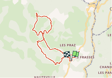

Length
10.6 km

Max alt
1505 m

Uphill gradient
628 m
Km-Effort
19 km

Min alt
945 m

Downhill gradient
628 m
Boucle
Yes
Creation date :
2023-02-14 08:48:34.25
Updated on :
2023-03-28 14:21:34.453
4h19
Difficulty : Very difficult

FREE GPS app for hiking
 SityTrail
IGN / Geographical institutes
SityTrail Plus
The world is yours!
About
Trail Walking of 10.6 km to be discovered at Auvergne-Rhône-Alpes, Savoy, Ugine. This trail is proposed by JPS73.
Positioning
Country:
France
Region :
Auvergne-Rhône-Alpes
Department/Province :
Savoy
Municipality :
Ugine
Location:
Unknown
Start:(Dec)
Start:(UTM)
303586 ; 5071932 (32T) N.
Comments