


test Bruges réabonnement

jeff2
User
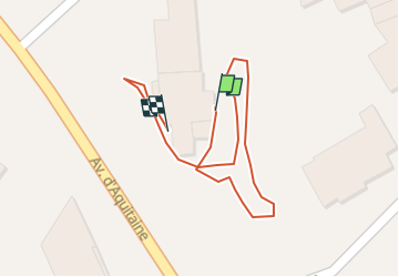

Length
131 m

Max alt
11 m

Uphill gradient
0 m
Km-Effort
131 m

Min alt
10 m

Downhill gradient
0 m
Boucle
No
Creation date :
2023-04-07 16:08:57.504
Updated on :
2023-04-07 16:13:18.943
4m
Difficulty : Very easy

FREE GPS app for hiking
 SityTrail
IGN / Geographical institutes
SityTrail Plus
The world is yours!
About
Trail Walking of 131 m to be discovered at New Aquitaine, Gironde, Bruges. This trail is proposed by jeff2.
Description
Test Bruges réabonnement 1
Positioning
Country:
France
Region :
New Aquitaine
Department/Province :
Gironde
Municipality :
Bruges
Location:
Unknown
Start:(Dec)
Start:(UTM)
689091 ; 4972430 (30T) N.
Comments