


Caranca m'as d'Albaret

FAUCET
User

Length
13.3 km

Max alt
1385 m

Uphill gradient
1052 m
Km-Effort
27 km

Min alt
836 m

Downhill gradient
1047 m
Boucle
Yes
Creation date :
2023-04-12 06:52:22.374
Updated on :
2023-04-12 13:07:40.183
4h29
Difficulty : Very difficult

FREE GPS app for hiking
 SityTrail
IGN / Geographical institutes
SityTrail Plus
The world is yours!
About
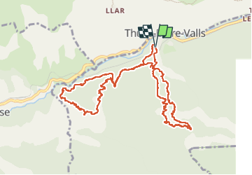
Trail Walking of 13.3 km to be discovered at Occitania, Pyrénées-Orientales, Thuès-Entre-Valls. This trail is proposed by FAUCET.
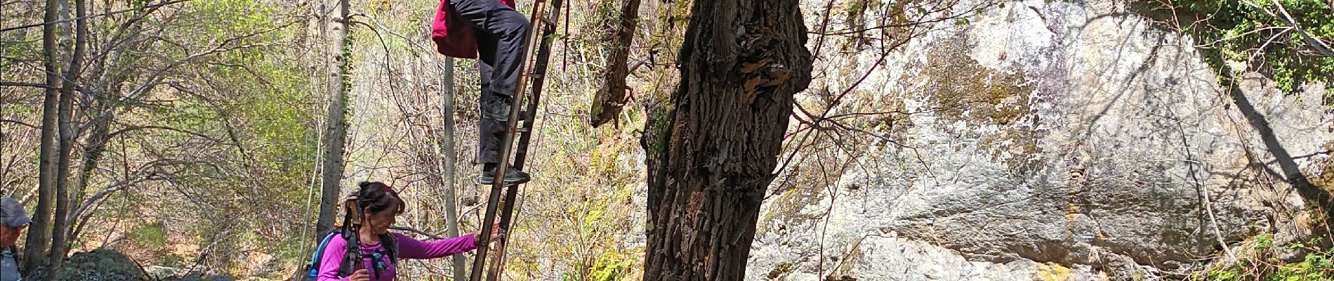
Photos


Positioning
Country:
France
Region :
Occitania
Department/Province :
Pyrénées-Orientales
Municipality :
Thuès-Entre-Valls
Location:
Unknown
Start:(Dec)
Start:(UTM)
436065 ; 4708135 (31T) N.
Comments