


estagel Roquefeuil

attitude73
User
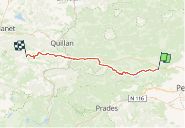

Length
78 km

Max alt
933 m

Uphill gradient
1933 m
Km-Effort
101 km

Min alt
78 m

Downhill gradient
1080 m
Boucle
No
Creation date :
2023-04-14 19:11:40.558
Updated on :
2023-05-14 09:54:43.879
--
Difficulty : Very difficult

FREE GPS app for hiking
 SityTrail
IGN / Geographical institutes
SityTrail Plus
The world is yours!
About
Trail Bicycle tourism of 78 km to be discovered at Occitania, Pyrénées-Orientales, Estagel. This trail is proposed by attitude73.
Positioning
Country:
France
Region :
Occitania
Department/Province :
Pyrénées-Orientales
Municipality :
Estagel
Location:
Unknown
Start:(Dec)
Start:(UTM)
475280 ; 4735481 (31T) N.
Comments