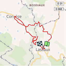
Trail Walking Lascaux - La Tine - Lascaux - Photo

La Tine - Lascaux

 houbart
houbart

User

© OpenStreetMap contributors
Length
Length
8.3 km
Max alt
Max alt
396 m
Uphill gradient
Uphill gradient
271 m
Km-Effort
Km-Effort  
11.9 km
Min alt
Min alt
251 m
Downhill gradient
Downhill gradient
269 m
Boucle
Boucle
Yes
Creation date :
2019-03-28 15:47:35.608
Updated on :
2019-03-28 15:47:35.66

(1 Reviews)

Walking
Walking
2h35
Difficulty : Medium

Scan this QR Code to open this trail in the SityTrail application

FREE GPS app for hiking

Logo SityTrail SityTrail

IGN / Geographical institutes

Download SityTrail from the App Store Download SityTrail from Google Play

Logo SityTrail SityTrail Plus

The world is yours!

Download SityTrail from the App Store Download SityTrail from Google Play Download SityTrail on Huawei AppGallery

About

Trail Walking of 8.3 km to be discovered at New Aquitaine, Corrèze, Lascaux. This trail is proposed by houbart.

Description

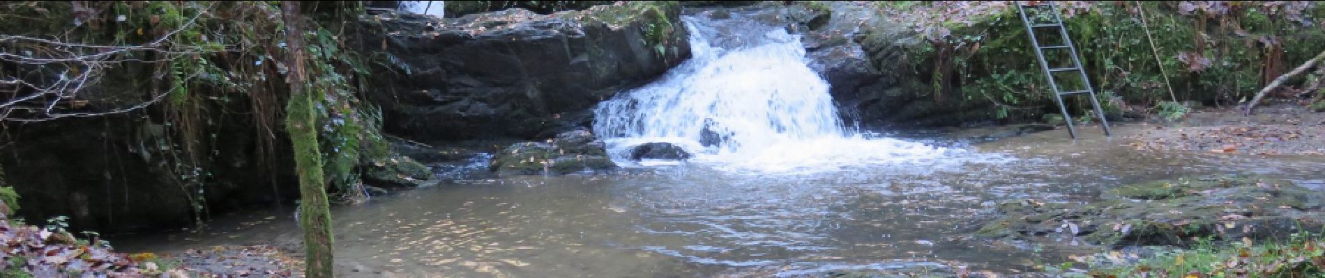
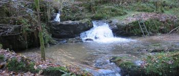
Départ de la placette située dans l'angle de la D86, pas loin de l'église. La Tine est une marmite creusée par le ruisseau. En automne, admirer la forêt de châtaigners.
Difficultés : 2 bonnes montées et passages de ruisseau sur poteau électrique et rondins glissants.

Elevation profile

Photos

Points of interest

Point of interest Lascaux - La Tine - Photo
houbart
LASCAUX 

Positioning

Country:
France
Region :
New Aquitaine
Department/Province :
Corrèze
Municipality :
Lascaux
Location:
Unknown
Start:(UTM)
371841 ; 5021967 (31T) N.

Comments

Please log in to post a review or rate the element


Close
My subscriptions