


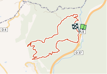

16.6 km | 23 km-effort


User


FREE GPS app for hiking
 SityTrail
IGN / Geographical institutes
SityTrail World
The world is yours!
Trail Walking of 10.7 km to be discovered at Provence-Alpes-Côte d'Azur, Var, Fréjus. This trail is proposed by eaea7charles.
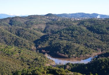
Belle montée au départ. Au retour, beau point de vue sur les vestiges de l'ancien barrage de Malpasset.
Walking
Walking

Walking

Mountain bike

Mountain bike
Walking

Walking

Walking

Walking