Trail Walking Saint-Égrève - 290423 Tour du Néron - Photo
© OpenStreetMap contributors
Length
Length
12.3 km
Max alt
Max alt
761 m
Uphill gradient
Uphill gradient
667 m
Km-Effort
Km-Effort  
21 km
Min alt
Min alt
207 m
Downhill gradient
Downhill gradient
712 m
Boucle
Boucle
No
Creation date :
2023-04-29 12:50:02.661
Updated on :
2023-04-29 17:13:14.304

(0 Reviews)

Walking
Walking
4h22
Difficulty : Very difficult

Scan this QR Code to open this trail in the SityTrail application

FREE GPS app for hiking

Logo SityTrail SityTrail

IGN / Geographical institutes

Download SityTrail from the App Store Download SityTrail from Google Play

Logo SityTrail SityTrail World

The world is yours!

Download SityTrail from the App Store Download SityTrail from Google Play Download SityTrail on Huawei AppGallery

About

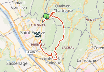
Trail Walking of 12.3 km to be discovered at Auvergne-Rhône-Alpes, Isère, Saint-Égrève. This trail is proposed by mzonzon05.

Description

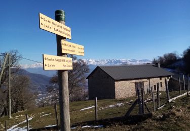
Joli tour de notre montagne par les anciennes batteries puis Narbone le Canet et SMV.
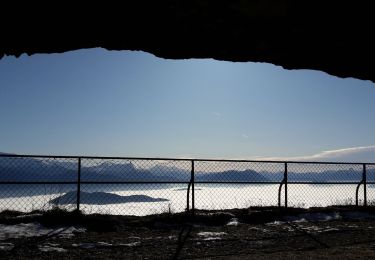
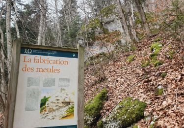
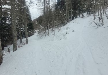
Terrain varié entre route forestière et sentier de chasseur. quelques très jolis points de vue sur Grenoble.

Elevation profile

Photos

Positioning

Country:
France
Region :
Auvergne-Rhône-Alpes
Department/Province :
Isère
Municipality :
Saint-Égrève
Location:
Unknown
Start:(UTM)
711379 ; 5013248 (31T) N.

Trails nearby

Trail Walking Sassenage - La ferme Durand - Photo
Walking
crocau

Walking

Easy
(1)
Sassenage, Auvergne-Rhône-Alpes, Isère, France
6.2 km | 13.3 km-effort
2h 7min
Yes
Trail Nordic walking Sassenage - Parc de l'Ovalie - Noyarey - Photo
Nordic walking
patjobou

Nordic walking

Easy
(1)
Sassenage, Auvergne-Rhône-Alpes, Isère, France
11.8 km | 13 km-effort
2h 20min
No
Trail Walking Corenc - Mont Saint-Eynard par le Pas Guiguet  - Photo
Walking
cmarit

Walking

Difficult
(2)
Corenc, Auvergne-Rhône-Alpes, Isère, France
10.9 km | 26 km-effort
6h 5min
Yes
Trail On foot La Tronche - Grande Traverse de Meylan - Photo
On foot
PRO

On foot

Easy
La Tronche, Auvergne-Rhône-Alpes, Isère, France
5.6 km | 6.5 km-effort
1h 28min
No
Trail Walking Proveysieux - le rocher de l'Eglise en traversee - Photo
Walking
cmarit

Walking

Difficult
(1)
Proveysieux, Auvergne-Rhône-Alpes, Isère, France
10.5 km | 22 km-effort
8h 16min
Yes
Trail Mountain bike La Tronche - bastille vtt - Photo
Mountain bike
virtumanu

Mountain bike

Medium
(1)
La Tronche, Auvergne-Rhône-Alpes, Isère, France
11.1 km | 19.6 km-effort
24min
Yes
Trail Walking Corenc - Mont Rachais par Corenc - Photo
Walking
flip38

Walking

Medium
Corenc, Auvergne-Rhône-Alpes, Isère, France
13.8 km | 25 km-effort
4h 26min
Yes
Trail Walking Mont-Saint-Martin - la Meulière des Dauphins par Mont St Martin - Photo
Walking
Ak38

Walking

Medium
Mont-Saint-Martin, Auvergne-Rhône-Alpes, Isère, France
6.3 km | 11.1 km-effort
1h 52min
Yes
Trail Touring skiing Proveysieux - 140124 Mont Fromage - Photo
Touring skiing
mzonzon05

Touring skiing

Easy
Proveysieux, Auvergne-Rhône-Alpes, Isère, France
8.5 km | 18 km-effort
3h 21min
Yes


Close
My subscriptions