


ANGOUSTRINE LLIVIA

gallo
User
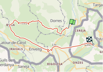

Length
18.5 km

Max alt
1700 m

Uphill gradient
593 m
Km-Effort
27 km

Min alt
1192 m

Downhill gradient
693 m
Boucle
No
Creation date :
2023-05-02 12:26:52.481
Updated on :
2023-05-02 12:29:08.496
6h04
Difficulty : Very difficult

FREE GPS app for hiking
 SityTrail
IGN / Geographical institutes
SityTrail Plus
The world is yours!
About
Trail Walking of 18.5 km to be discovered at Occitania, Pyrénées-Orientales, Angoustrine-Villeneuve-des-Escaldes. This trail is proposed by gallo.
Positioning
Country:
France
Region :
Occitania
Department/Province :
Pyrénées-Orientales
Municipality :
Angoustrine-Villeneuve-des-Escaldes
Location:
Unknown
Start:(Dec)
Start:(UTM)
414122 ; 4703381 (31T) N.
Comments