Trail Walking Montsapey - petit arc par bataille dessus printemps - Photo

petit arc par bataille dessus printemps

© OpenStreetMap contributors
Length
Length
9.2 km
Max alt
Max alt
2352 m
Uphill gradient
Uphill gradient
987 m
Km-Effort
Km-Effort  
22 km
Min alt
Min alt
1406 m
Downhill gradient
Downhill gradient
981 m
Boucle
Boucle
Yes
Creation date :
2023-05-03 06:03:08.656
Updated on :
2023-05-03 10:51:14.513

(0 Reviews)

Walking
Walking
4h29
Difficulty : Difficult

Scan this QR Code to open this trail in the SityTrail application

FREE GPS app for hiking

Logo SityTrail SityTrail

IGN / Geographical institutes

Download SityTrail from the App Store Download SityTrail from Google Play

Logo SityTrail SityTrail World

The world is yours!

Download SityTrail from the App Store Download SityTrail from Google Play Download SityTrail on Huawei AppGallery

About

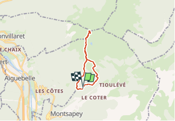
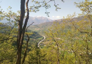
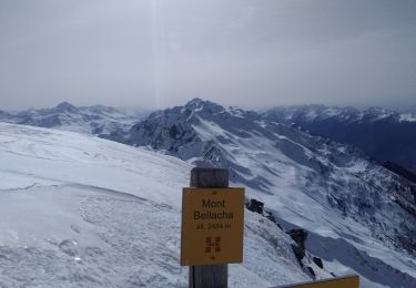
Trail Walking of 9.2 km to be discovered at Auvergne-Rhône-Alpes, Savoy, Montsapey. This trail is proposed by jibebouvier.

Description

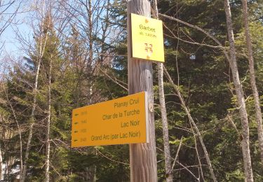
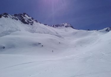
de bataille dessus on récupère la crête jusqu'au char de la turche
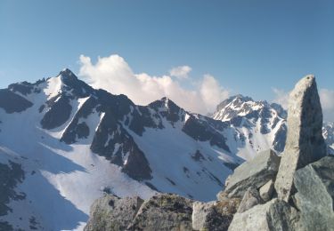
crampons obligatoires au char de la turche, puis la crête toujours, jusqu'au petit arc.
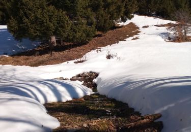
neige trop molle pour récupérer le lac noir, donc retour par la crête, puis variante au char de la turche pour rejoindre la piste à Barbet
côté difficile car nécessite un équipement, variable selon la quantité de neige

Elevation profile

Photos

Positioning

Country:
France
Region :
Auvergne-Rhône-Alpes
Department/Province :
Savoy
Municipality :
Montsapey
Location:
Unknown
Start:(UTM)
293159 ; 5045959 (32T) N.

Trails nearby

Trail Walking Val-d'Arc - Grand Arc - Photo
Walking
kheops74

Walking

Very difficult
(1)
Val-d'Arc, Auvergne-Rhône-Alpes, Savoy, France
7.7 km | 28 km-effort
5h 0min
No
Trail Walking La Léchère - lac de Clartan et grande muraille  - Photo
Walking
nadd73

Walking

Difficult
La Léchère, Auvergne-Rhône-Alpes, Savoy, France
4.6 km | 9.9 km-effort
3h 7min
Yes
Trail Walking Val-d'Arc - tour du haut de Randens - Photo
Walking
jibebouvier

Walking

Medium
Val-d'Arc, Auvergne-Rhône-Alpes, Savoy, France
13 km | 31 km-effort
2h 48min
Yes
Trail Walking Montsapey - la chapelle de montsap' lac noir  - Photo
Walking
jibebouvier

Walking

Difficult
Montsapey, Auvergne-Rhône-Alpes, Savoy, France
11.5 km | 26 km-effort
4h 51min
Yes
Trail Walking Saint-Georges-d'Hurtières - la lechere/plan du bourg- Val d'arc - Photo
Walking
jibebouvier

Walking

Medium
Saint-Georges-d'Hurtières, Auvergne-Rhône-Alpes, Savoy, France
5.7 km | 10.5 km-effort
1h 19min
No
Trail Walking Val-d'Arc - les Mauilles - Photo
Walking
jibebouvier

Walking

Difficult
Val-d'Arc, Auvergne-Rhône-Alpes, Savoy, France
8.8 km | 22 km-effort
5h 42min
No
Trail Walking Argentine - pointe st jacques de l place du dîner - Photo
Walking
jibebouvier

Walking

Difficult
Argentine, Auvergne-Rhône-Alpes, Savoy, France
11.4 km | 30 km-effort
4h 23min
Yes
Trail Touring skiing Montsapey - Combe bronsin collu au Nord 2400 - Photo
Touring skiing
nadd73

Touring skiing

Easy
Montsapey, Auvergne-Rhône-Alpes, Savoy, France
10 km | 25 km-effort
4h 19min
No
Trail Touring skiing Montsapey - Mont Bellacha  - Photo
Touring skiing
nadd73

Touring skiing

Difficult
Montsapey, Auvergne-Rhône-Alpes, Savoy, France
8.9 km | 25 km-effort
4h 35min
Yes


Close
My subscriptions