


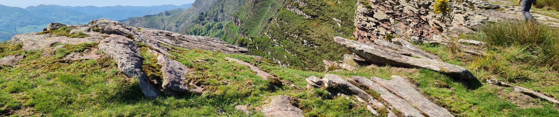
iparla
© OpenStreetMap contributors


4h53
Difficulty : Difficult


Length
14.2 km
Max alt
1037 m
Uphill gradient
954 m
Km-Effort
27 km
Min alt
131 m
Downhill gradient
954 m
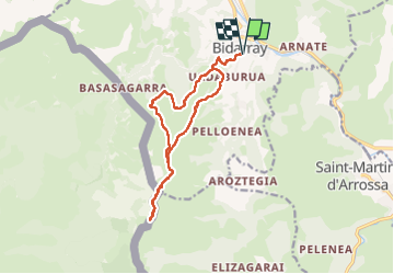
Boucle
Yes
Creation date :
2023-05-04 06:45:17.505
Updated on :
2023-05-04 13:48:04.086
4h53
Difficulty : Difficult
FREE GPS app for hiking
 SityTrail
IGN / Geographical institutes
SityTrail Plus
The world is yours!
About
Trail Walking of 14.2 km to be discovered at New Aquitaine, Pyrénées-Atlantiques, Bidarray. This trail is proposed by ChristopheLefauconnier.
Photos


Positioning
Country:
France
Region :
New Aquitaine
Department/Province :
Pyrénées-Atlantiques
Municipality :
Bidarray
Location:
Unknown
Start:(Dec)
Start:(UTM)
633918 ; 4791624 (30T) N.
Comments