Trail Walking Dolleren - Autour du Ballon d'Alsacen - Photo

Autour du Ballon d'Alsacen

 markrei
markrei

User

© OpenStreetMap contributors
Length
Length
30 km
Max alt
Max alt
1245 m
Uphill gradient
Uphill gradient
1344 m
Km-Effort
Km-Effort  
48 km
Min alt
Min alt
464 m
Downhill gradient
Downhill gradient
1544 m
Boucle
Boucle
No
Creation date :
2014-12-10 00:00:00.0
Updated on :
2014-12-10 00:00:00.0

(0 Reviews)

Walking
Walking
9h37
Difficulty : Medium

Scan this QR Code to open this trail in the SityTrail application

FREE GPS app for hiking

Logo SityTrail SityTrail

IGN / Geographical institutes

Download SityTrail from the App Store Download SityTrail from Google Play

Logo SityTrail SityTrail World

The world is yours!

Download SityTrail from the App Store Download SityTrail from Google Play Download SityTrail on Huawei AppGallery

About

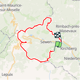
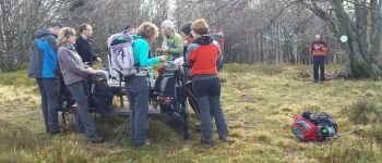
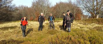
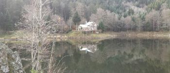
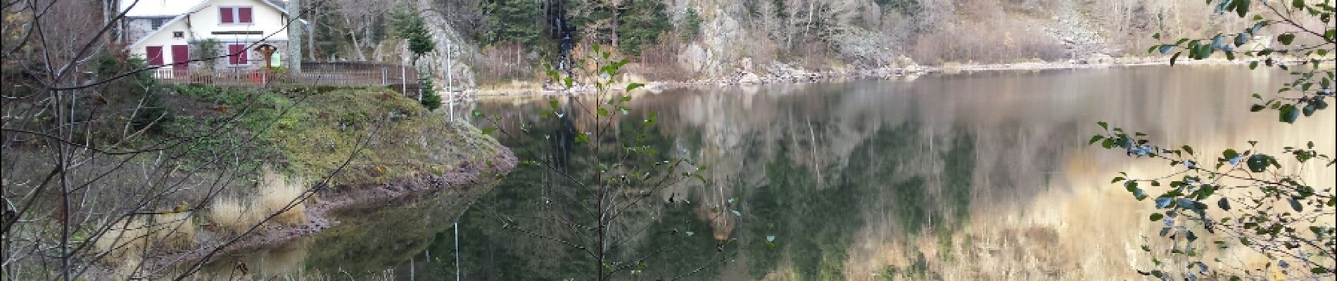
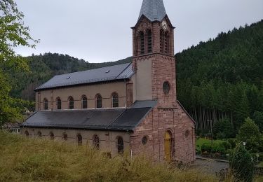
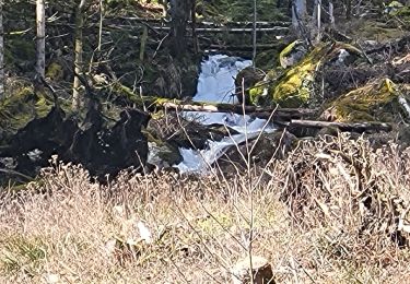
Trail Walking of 30 km to be discovered at Grand Est, Haut-Rhin, Dolleren. This trail is proposed by markrei.

Description

Le Schlumpf-Source de la Doller- Tremontkopf-Le Wissgrut-Refuge CAF du Lagenberg-Ballpn d'Alsace-Ronde Tête- Abri Haute Bers-Moyenne Bers-Grand Neuweiher-Le Gresson Bas-Oberbruck
Guide : Bernard Risch

Elevation profile

Photos

Points of interest

Point of interest Riervescemont - Col du Hirtzelach - Photo
markrei
RIERVESCEMONT 
Point of interest Sewen - Tremontkopf - Photo
markrei
Point of interest Lepuix - Wissgrut - Photo
markrei
LEPUIX 
Point of interest Lepuix - Ballon d'Alsace - Photo
markrei
Point of interest Sewen - Rond de Tête - Photo
markrei
Point of interest Saint-Maurice-sur-Moselle - Point de vue - Photo
markrei
SAINT-MAURICE-SUR-MOSELLE 
Point of interest Rimbach-près-Masevaux - Moyenne Bers - Photo
markrei
RIMBACH-PRÈS-MASEVAUX 
Point of interest Rimbach-près-Masevaux - Le grand Neuweiher - Photo
markrei
RIMBACH-PRÈS-MASEVAUX 
Point of interest Rimbach-près-Masevaux - Le Grand Neuweiher - Photo
markrei
RIMBACH-PRÈS-MASEVAUX 
Point of interest Rimbach-près-Masevaux - Le Grand Neuweiher - Photo
markrei
RIMBACH-PRÈS-MASEVAUX 
Point of interest Rimbach-près-Masevaux - Le Grand Neuweiher - Photo
markrei
RIMBACH-PRÈS-MASEVAUX 
Point of interest Dolleren - Source de la Doller - Photo
markrei
Point of interest Sewen - Col sans Nom - Photo
markrei
Point of interest Sewen - Le Langenberg - Photo
markrei
Point of interest Oberbruck - Le Gresson Bas - Photo
markrei
OBERBRUCK 

Positioning

Country:
France
Region :
Grand Est
Department/Province :
Haut-Rhin
Municipality :
Dolleren
Location:
Unknown
Start:(UTM)
344370 ; 5295451 (32T) N.

Trails nearby

Trail Walking Rimbach-près-Masevaux - Haute Bers - Photo
Walking
helmut68

Walking

Medium
(1)
Rimbach-près-Masevaux, Grand Est, Haut-Rhin, France
12 km | 20 km-effort
3h 25min
Yes
Trail Walking Sewen - Boucle entre les lacs de Sewen et d'Alfeld - Photo
Walking
tracegps

Walking

Medium
(1)
Sewen, Grand Est, Haut-Rhin, France
8.1 km | 12.3 km-effort
2h 30min
Yes
Trail Walking Sewen - lac d'Alfeld  - Photo
Walking
klopbill

Walking

Very difficult
(1)
Sewen, Grand Est, Haut-Rhin, France
17.1 km | 28 km-effort
8h 7min
Yes
Trail Walking Kirchberg - 2022-07-15 Marche Refuge Baerenkopf Auberge Gazon Vert - Photo
Walking
GUIDE
holtzv

Walking

Very difficult
Kirchberg, Grand Est, Haut-Rhin, France
23 km | 38 km-effort
8h 21min
No
Trail Walking Masevaux-Niederbruck - Rando CLAS du 25/04/2024 - Photo
Walking
boubou68

Walking

Very difficult
Masevaux-Niederbruck, Grand Est, Haut-Rhin, France
17 km | 28 km-effort
4h 24min
Yes
Trail Walking Kirchberg - Rando du 11/04/2024  ..Marcheurs - Photo
Walking
boubou68

Walking

Very difficult
Kirchberg, Grand Est, Haut-Rhin, France
23 km | 37 km-effort
5h 37min
Yes
Trail Walking Sewen - Rando des Marcheurs par Alain..13/03/2024 - Photo
Walking
boubou68

Walking

Very difficult
Sewen, Grand Est, Haut-Rhin, France
18.9 km | 31 km-effort
5h 36min
Yes
Trail Walking Sewen - Sewen - abris de Dolleren et du Sommerseite - Lachtelweiher - Col du Lochberg - Wissgrut - Photo
Walking
Bart2015

Walking

Very difficult
Sewen, Grand Est, Haut-Rhin, France
24 km | 39 km-effort
8h 58min
Yes
Trail Walking Rimbach-près-Masevaux - Rimbach - lacs du Neuweiher et des Perches par Rouge Gazon - Photo
Walking
Bart2015

Walking

Very difficult
Rimbach-près-Masevaux, Grand Est, Haut-Rhin, France
17.1 km | 28 km-effort
6h 18min
Yes


Close
My subscriptions