


Randonnée du 05/03/2023 à 14:47

houbart
User
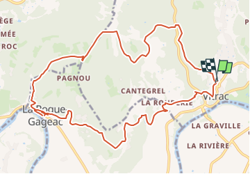

Length
13.2 km

Max alt
241 m

Uphill gradient
491 m
Km-Effort
19.7 km

Min alt
66 m

Downhill gradient
489 m
Boucle
Yes
Creation date :
2023-05-07 13:41:57.19
Updated on :
2023-05-13 06:59:03.529
4h28
Difficulty : Very difficult

FREE GPS app for hiking
 SityTrail
IGN / Geographical institutes
SityTrail Plus
The world is yours!
About
Trail Walking of 13.2 km to be discovered at New Aquitaine, Dordogne, Vitrac. This trail is proposed by houbart.
Description
Variante de celle de 15 km
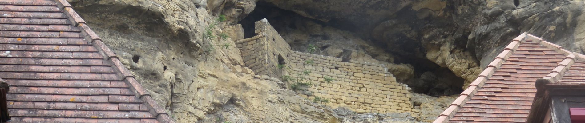
Photos


Positioning
Country:
France
Region :
New Aquitaine
Department/Province :
Dordogne
Municipality :
Vitrac
Location:
Unknown
Start:(Dec)
Start:(UTM)
359748 ; 4965743 (31T) N.
Comments