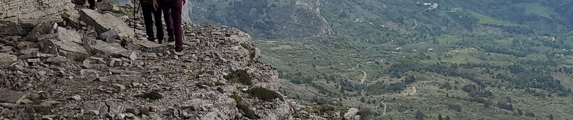
geruen sentier des chamois

Danielba
User GUIDE
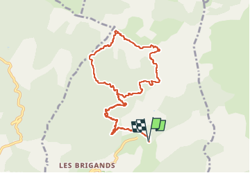

Length
11 km

Max alt
1880 m

Uphill gradient
791 m
Km-Effort
22 km

Min alt
1115 m

Downhill gradient
793 m
Boucle
Yes
Creation date :
2023-05-09 06:46:42.127
Updated on :
2023-05-09 16:48:54.72
7h15
Difficulty : Very difficult

FREE GPS app for hiking
 SityTrail
IGN / Geographical institutes
SityTrail Plus
The world is yours!
About
Trail Walking of 11 km to be discovered at Provence-Alpes-Côte d'Azur, Alpes-de-Haute-Provence, Hautes-Duyes. This trail is proposed by Danielba .
Photos


Positioning
Country:
France
Region :
Provence-Alpes-Côte d'Azur
Department/Province :
Alpes-de-Haute-Provence
Municipality :
Hautes-Duyes
Location:
Unknown
Start:(Dec)
Start:(UTM)
274889 ; 4898097 (32T) N.
Comments