


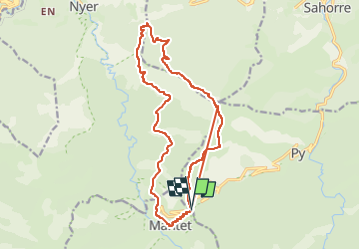
MANTET par le TRES ESTELLES et la vallée de NYER

FAUCET
User

Length
25 km

Max alt
2102 m

Uphill gradient
1757 m
Km-Effort
48 km

Min alt
1209 m

Downhill gradient
1761 m
Boucle
Yes
Creation date :
2023-05-17 12:39:41.198
Updated on :
2023-05-17 12:39:43.8
10h53
Difficulty : Very difficult

FREE GPS app for hiking
 SityTrail
IGN / Geographical institutes
SityTrail Plus
The world is yours!
About
Trail Walking of 25 km to be discovered at Occitania, Pyrénées-Orientales, Mantet. This trail is proposed by FAUCET.
Positioning
Country:
France
Region :
Occitania
Department/Province :
Pyrénées-Orientales
Municipality :
Mantet
Location:
Unknown
Start:(Dec)
Start:(UTM)
443603 ; 4703440 (31T) N.
Comments