


SAVOIE: CHANAZ - SAINT PIERRE DE CURTILLE - JONGIEUX

djeepee74
User
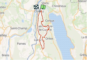

Length
26 km

Max alt
570 m

Uphill gradient
827 m
Km-Effort
37 km

Min alt
276 m

Downhill gradient
826 m
Boucle
Yes
Creation date :
2023-05-19 06:42:25.272
Updated on :
2023-05-20 07:11:23.594
8h19
Difficulty : Difficult

FREE GPS app for hiking
 SityTrail
IGN / Geographical institutes
SityTrail Plus
The world is yours!
About
Trail Walking of 26 km to be discovered at Auvergne-Rhône-Alpes, Savoy, Chanaz. This trail is proposed by djeepee74.
Description
BOUCLE... live le 20230520
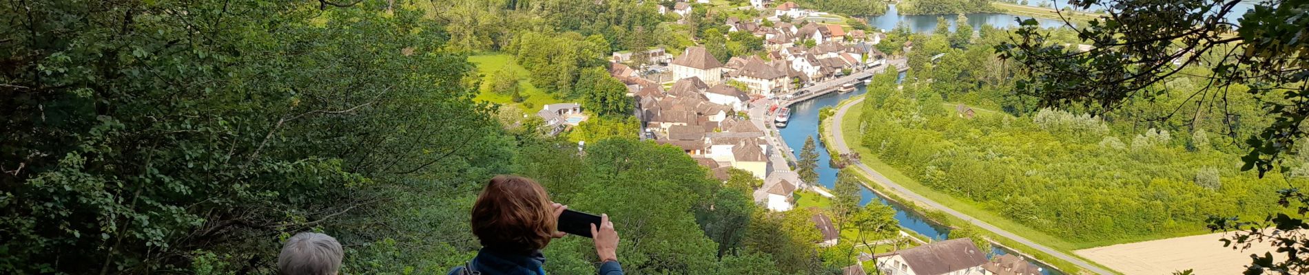
Photos


Positioning
Country:
France
Region :
Auvergne-Rhône-Alpes
Department/Province :
Savoy
Municipality :
Chanaz
Location:
Unknown
Start:(Dec)
Start:(UTM)
717042 ; 5076331 (31T) N.
Comments