


Sentier historique - Mittlach - Fischboedle

Claudele
User
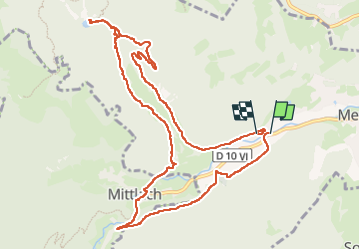

Length
11.5 km

Max alt
815 m

Uphill gradient
497 m
Km-Effort
18.1 km

Min alt
492 m

Downhill gradient
493 m
Boucle
Yes
Creation date :
2023-05-21 07:37:09.743
Updated on :
2023-05-21 14:36:04.206
4h26
Difficulty : Medium

FREE GPS app for hiking
 SityTrail
IGN / Geographical institutes
SityTrail Plus
The world is yours!
About
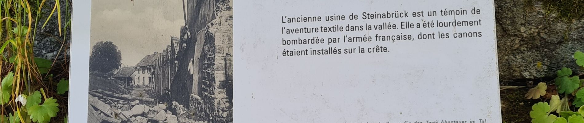
Trail Walking of 11.5 km to be discovered at Grand Est, Haut-Rhin, Metzeral. This trail is proposed by Claudele.
Photos


62 photos in total. Please click on a photo to see them all in the gallery.
Positioning
Country:
France
Region :
Grand Est
Department/Province :
Haut-Rhin
Municipality :
Metzeral
Location:
Unknown
Start:(Dec)
Start:(UTM)
354913 ; 5319320 (32U) N.
Comments