


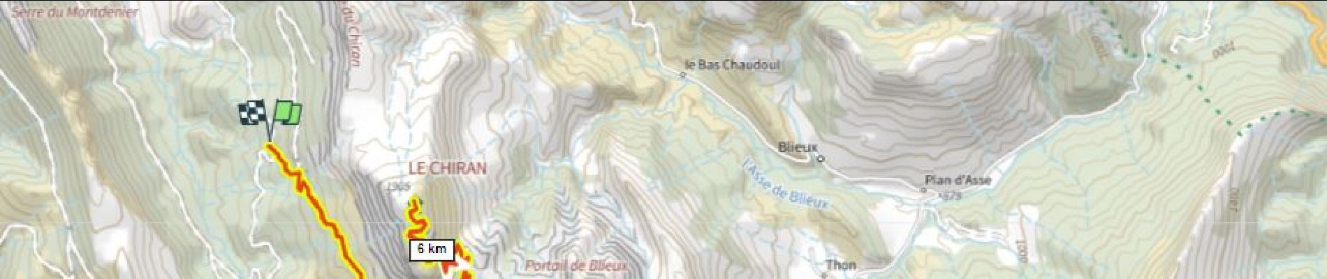
Observatoire Mt Chiran 1900m D+600m

ericberlin
User
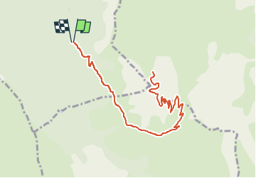

Length
14.2 km

Max alt
1897 m

Uphill gradient
587 m
Km-Effort
22 km

Min alt
1336 m

Downhill gradient
589 m
Boucle
Yes
Creation date :
2023-05-27 18:31:28.503
Updated on :
2023-05-27 19:00:33.042
5h00
Difficulty : Very difficult
1h31
Difficulty : Medium

FREE GPS app for hiking
 SityTrail
IGN / Geographical institutes
SityTrail Plus
The world is yours!
About
Trail Walking of 14.2 km to be discovered at Provence-Alpes-Côte d'Azur, Alpes-de-Haute-Provence, Majastres. This trail is proposed by ericberlin.
Description
Photos

Positioning
Country:
France
Region :
Provence-Alpes-Côte d'Azur
Department/Province :
Alpes-de-Haute-Provence
Municipality :
Majastres
Location:
Unknown
Start:(Dec)
Start:(UTM)
282871 ; 4861386 (32T) N.
Comments