Trail Walking Saint-Martin-d'Arrossa - 2023-05-31_09h58m49_st-martin-d-arrossa-larla-sentier-des-mines - Photo

2023-05-31_09h58m49_st-martin-d-arrossa-larla-sentier-des-mines

© OpenStreetMap contributors
Length
Length
9.7 km
Max alt
Max alt
645 m
Uphill gradient
Uphill gradient
474 m
Km-Effort
Km-Effort  
16 km
Min alt
Min alt
302 m
Downhill gradient
Downhill gradient
474 m
Boucle
Boucle
Yes
Creation date :
2023-05-31 07:58:49.684
Updated on :
2024-01-10 15:56:26.345

(1 Reviews)

Walking
Walking
3h38
Difficulty : Difficult

Scan this QR Code to open this trail in the SityTrail application

FREE GPS app for hiking

Logo SityTrail SityTrail

IGN / Geographical institutes

Download SityTrail from the App Store Download SityTrail from Google Play

Logo SityTrail SityTrail World

The world is yours!

Download SityTrail from the App Store Download SityTrail from Google Play Download SityTrail on Huawei AppGallery

About

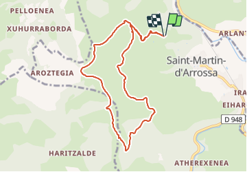
Trail Walking of 9.7 km to be discovered at New Aquitaine, Pyrénées-Atlantiques, Saint-Martin-d'Arrossa. This trail is proposed by Geo40 caching.

Description

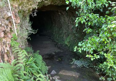
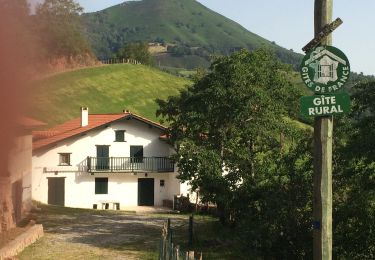
Petite randonnée sur le PR du Larla sentier des Mines  ( commune de St Martin d'Arrossa).
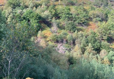
Ce PR nous fera faire le tour du Larla  en mettant à profit pistes et sentiers .  Des panneaux d'interprétation sont placés sur le parcours, et au final, on passera devant l'entrée de mines récentes.
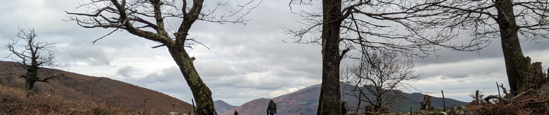
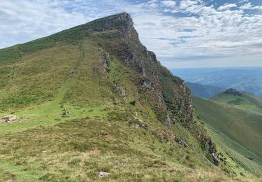
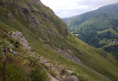
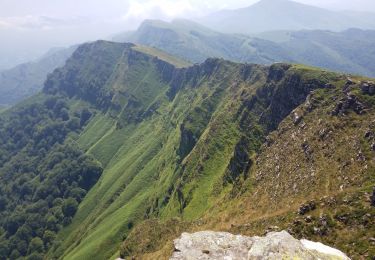
Parcours très panoramique avec vues sur toutes les montagnes voisines.
Parcours balisé en rouge   logo spécifique .

[url=https://gb-rando.blogspot.com/2018/09/larla-sentier-des-mines.html]voir rando[/url]

Elevation profile

Photos

Positioning

Country:
France
Region :
New Aquitaine
Department/Province :
Pyrénées-Atlantiques
Municipality :
Saint-Martin-d'Arrossa
Location:
Unknown
Start:(UTM)
636261 ; 4789202 (30T) N.

Comments

Please log in to post a review or rate the element


une superbe balade et découverte 👍😊


Trails nearby

Trail Walking Ossès - haltzamendi - Photo
Walking
jcaudron

Walking

Very easy
(1)
Ossès, New Aquitaine, Pyrénées-Atlantiques, France
14.5 km | 26 km-effort
5h 13min
Yes
Trail Walking Saint-Martin-d'Arrossa - Sommet de Larla en boucle de Saint Martin d'Arrossa - Photo
Walking
tracegps

Walking

Difficult
(2)
Saint-Martin-d'Arrossa, New Aquitaine, Pyrénées-Atlantiques, France
9.5 km | 15.9 km-effort
4h 0min
Yes
Trail Walking Saint-Étienne-de-Baïgorry - iparla - Photo
Walking
jcaudron

Walking

Very easy
(1)
Saint-Étienne-de-Baïgorry, New Aquitaine, Pyrénées-Atlantiques, France
13.5 km | 25 km-effort
4h 45min
Yes
Trail Walking Saint-Martin-d'Arrossa - Chemin des mineurs  - Photo
Walking
RVMASSON

Walking

Medium
(1)
Saint-Martin-d'Arrossa, New Aquitaine, Pyrénées-Atlantiques, France
9.7 km | 16 km-effort
3h 23min
Yes
Trail Walking Bidarray - GR 10 - 4ème étape : Bidarray - St Etienne de Baigorryg - Photo
Walking
LEGUE

Walking

Very difficult
Bidarray, New Aquitaine, Pyrénées-Atlantiques, France
18.1 km | 34 km-effort
4h 58min
No
Trail Walking Bidarray - col de mehatse - Photo
Walking
gamille67

Walking

Easy
Bidarray, New Aquitaine, Pyrénées-Atlantiques, France
17.7 km | 29 km-effort
4h 32min
Yes
Trail Walking Bidarray - bidarray Iparla - Photo
Walking
gamille67

Walking

Difficult
Bidarray, New Aquitaine, Pyrénées-Atlantiques, France
25 km | 44 km-effort
6h 49min
Yes
Trail Walking Bidarray - Bidarray harrihandi aritzakun - Photo
Walking
GUIDE
antignacs

Walking

Difficult
Bidarray, New Aquitaine, Pyrénées-Atlantiques, France
23 km | 34 km-effort
7h 4min
Yes
Trail Walking Bidarray - Arrisondo - Photo
Walking
RVMASSON

Walking

Very difficult
Bidarray, New Aquitaine, Pyrénées-Atlantiques, France
8.9 km | 16.1 km-effort
3h 26min
Yes


Close
My subscriptions