


Thann

claudel
User
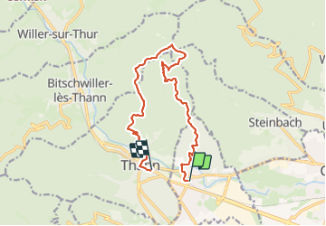

Length
13.5 km

Max alt
877 m

Uphill gradient
630 m
Km-Effort
22 km

Min alt
325 m

Downhill gradient
621 m
Boucle
No
Creation date :
2023-06-07 09:08:52.882
Updated on :
2023-06-07 13:51:44.134
3h03
Difficulty : Difficult

FREE GPS app for hiking
 SityTrail
IGN / Geographical institutes
SityTrail Plus
The world is yours!
About
Trail Walking of 13.5 km to be discovered at Grand Est, Haut-Rhin, Vieux-Thann. This trail is proposed by claudel.
Positioning
Country:
France
Region :
Grand Est
Department/Province :
Haut-Rhin
Municipality :
Vieux-Thann
Location:
Unknown
Start:(Dec)
Start:(UTM)
359316 ; 5296468 (32T) N.
Comments