


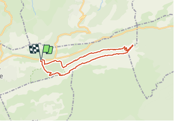


8.4 km | 15.5 km-effort

User GUIDE


FREE GPS app for hiking
 SityTrail
IGN / Geographical institutes
SityTrail World
The world is yours!
Trail On foot of 15 km to be discovered at Provence-Alpes-Côte d'Azur, Var, Plan-d'Aups-Sainte-Baume. This trail is proposed by rvapeldo.
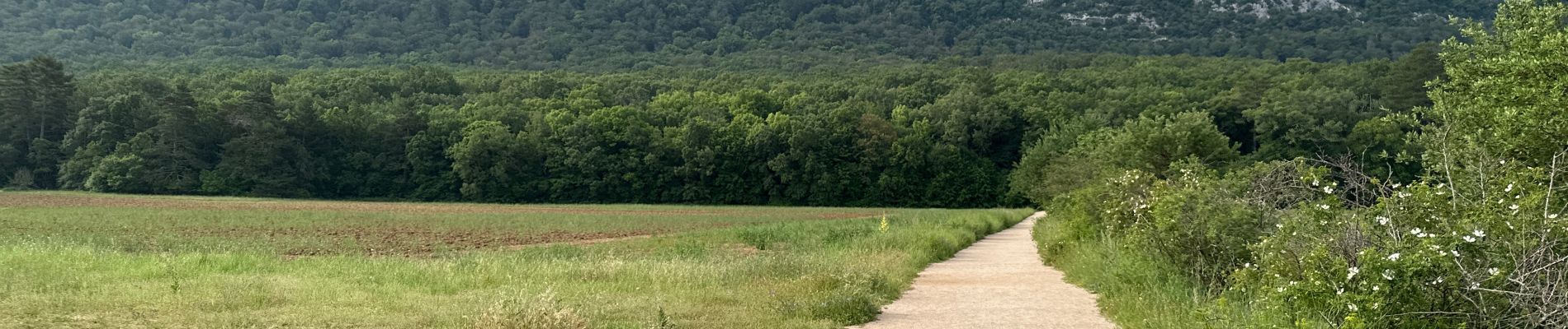
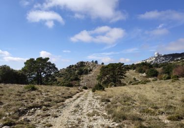
Bonne randonnée montagnarde sur la crête du massif de Sainte Baume. Elle démarre avec une longue et douce montée vers le pas de l’Aï.
Il y a deux passages un peu délicats, pas trop difficiles pour les marcheurs habitués à la montagne, où il faudra utiliser les mains. Il y a moyen de prolonger la balade en allant un peu plus loin sur la crête avant de descendre par le col de Saint Pilon. Ou en remontant vers la grotte de Marie-Madeleine qui est fort impressionnante. Le dénivelé total est assez modéré pour une randonnée de montagne, environ 500 mètres.


22 photos in total. Please click on a photo to see them all in the gallery.

Walking

Walking

Walking

Walking

Walking

Walking

Walking

Walking
Walking