Trail Walking Sentheim - Baerenkopf  - Photo
 helmut68
helmut68

User

© OpenStreetMap contributors
Length
Length
33 km
Max alt
Max alt
1069 m
Uphill gradient
Uphill gradient
1163 m
Km-Effort
Km-Effort  
49 km
Min alt
Min alt
360 m
Downhill gradient
Downhill gradient
1163 m
Boucle
Boucle
Yes
Creation date :
2023-06-06 07:28:42.945
Updated on :
2023-10-22 20:14:25.981

(0 Reviews)

Walking
Walking
7h00
Difficulty : Difficult

Scan this QR Code to open this trail in the SityTrail application

FREE GPS app for hiking

Logo SityTrail SityTrail

IGN / Geographical institutes

Download SityTrail from the App Store Download SityTrail from Google Play

Logo SityTrail SityTrail World

The world is yours!

Download SityTrail from the App Store Download SityTrail from Google Play Download SityTrail on Huawei AppGallery

About

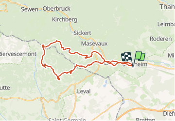
Trail Walking of 33 km to be discovered at Grand Est, Haut-Rhin, Sentheim. This trail is proposed by helmut68.

Description

Rando aller retour Sentheim Baerenkopf . C'est une boucle assez difficile puisqu'après une première montée aux ruines du château de Montori , au kilomètre  8 , une deuxième vous attend au kilomètre 18 , le Baerenkopf  .
Ensuite il y a le retour , certes en descente, mais encore environ 15km pour arriver à terme . C'est un peu beaucoup pour une journée ...., mais faisable . Une très belle boucle , en grande partie sur deux GR , le 5 et le 531 .
Alors à vos chaussures !!!

Elevation profile

Photos

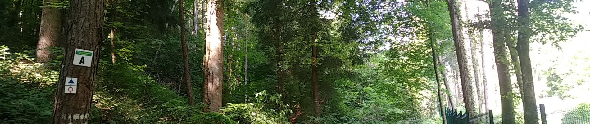
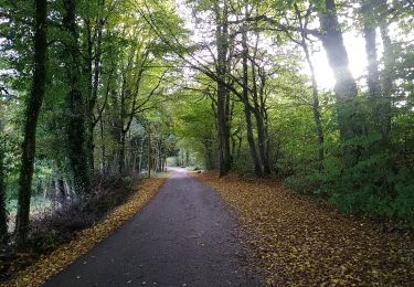
23 photos in total. Please click on a photo to see them all in the gallery.

Positioning

Country:
France
Region :
Grand Est
Department/Province :
Haut-Rhin
Municipality :
Sentheim
Location:
Unknown
Start:(UTM)
353911 ; 5290597 (32T) N.

Trails nearby

Trail Walking Masevaux-Niederbruck - Masevaux - Rossberg par le belvédère du Fuchsfelsen - Photo
Walking
Bart2015

Walking

Medium
(1)
Masevaux-Niederbruck, Grand Est, Haut-Rhin, France
19.9 km | 34 km-effort
4h 44min
Yes
Trail Walking Sentheim - Sentheim Rossberg - Photo
Walking
helmut68

Walking

Medium
(1)
Sentheim, Grand Est, Haut-Rhin, France
27 km | 40 km-effort
6h 11min
Yes
Trail Walking Lauw - 2022-07-14 Marche Lauw Refuge CAF Baerenkopf - Photo
Walking
GUIDE
holtzv

Walking

Very difficult
Lauw, Grand Est, Haut-Rhin, France
18.4 km | 31 km-effort
5h 35min
No
Trail On foot Sentheim - Sentier géologique du Wolfloch - Photo
On foot
PRO

On foot

Easy
Sentheim, Grand Est, Haut-Rhin, France
3.8 km | 4.8 km-effort
1h 5min
No
Trail On foot Sentheim - Sentheim - Bergwald - Eichwald - Guevenheim - Sentheim - Photo
On foot
patrickbeyrath

On foot

Easy
(1)
Sentheim, Grand Est, Haut-Rhin, France
13.4 km | 16.6 km-effort
Unknown
Yes
Trail Walking Sentheim - Knapphutte Saegenkopf Hütte - Photo
Walking
helmut68

Walking

Medium
Sentheim, Grand Est, Haut-Rhin, France
13.8 km | 17.2 km-effort
5h 11min
Yes
Trail Walking Sentheim - Montori - Photo
Walking
helmut68

Walking

Medium
Sentheim, Grand Est, Haut-Rhin, France
17.7 km | 24 km-effort
4h 47min
Yes
Trail Mountain bike Sentheim - AperoDioller - Photo
Mountain bike
helmut68

Mountain bike

Easy
Sentheim, Grand Est, Haut-Rhin, France
24 km | 27 km-effort
1h 23min
Yes
Trail Walking Sentheim - Lac Seigneurie Soultzbach - Photo
Walking
helmut68

Walking

Easy
Sentheim, Grand Est, Haut-Rhin, France
10.9 km | 12.7 km-effort
3h 26min
Yes


Close
My subscriptions