


t46003204_circuit n-11 - aux confins du quercy

Gpoujade
User

Length
15.6 km

Max alt
197 m

Uphill gradient
239 m
Km-Effort
18.8 km

Min alt
126 m

Downhill gradient
241 m
Boucle
Yes
Creation date :
2023-06-09 16:37:00.0
Updated on :
2024-02-15 10:18:07.414
4h15
Difficulty : Difficult

FREE GPS app for hiking
 SityTrail
IGN / Geographical institutes
SityTrail Plus
The world is yours!
About
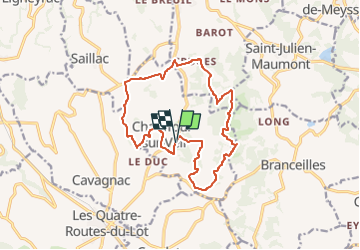
Trail Walking of 15.6 km to be discovered at New Aquitaine, Corrèze, Chauffour-sur-Vell. This trail is proposed by Gpoujade.
Description
Boucle au départ du château du Mazot à Chauffour Sur Vell
Positioning
Country:
France
Region :
New Aquitaine
Department/Province :
Corrèze
Municipality :
Chauffour-sur-Vell
Location:
Unknown
Start:(Dec)
Start:(UTM)
395164 ; 4985651 (31T) N.
Comments