


pic canigou moura St Martin vernet

FAUCET
User
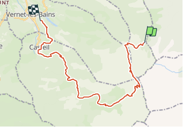

Length
19 km

Max alt
2747 m

Uphill gradient
869 m
Km-Effort
35 km

Min alt
797 m

Downhill gradient
2170 m
Boucle
No
Creation date :
2023-06-10 17:56:11.53
Updated on :
2023-06-10 17:56:16.6
7h56
Difficulty : Very difficult

FREE GPS app for hiking
 SityTrail
IGN / Geographical institutes
SityTrail Plus
The world is yours!
About
Trail Walking of 19 km to be discovered at Occitania, Pyrénées-Orientales, Taurinya. This trail is proposed by FAUCET.
Positioning
Country:
France
Region :
Occitania
Department/Province :
Pyrénées-Orientales
Municipality :
Taurinya
Location:
Unknown
Start:(Dec)
Start:(UTM)
456071 ; 4709226 (31T) N.
Comments