


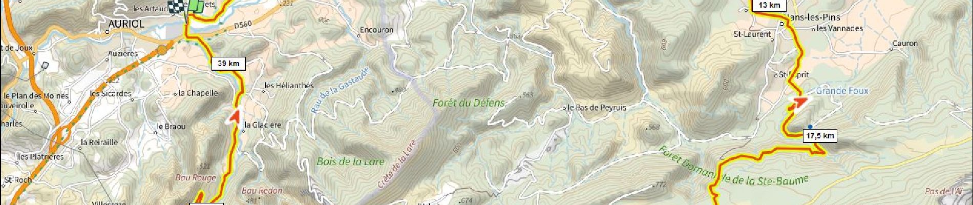
Plan d'Aups 670m+ depuis Auriol

ericberlin
User
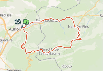

Length
40 km

Max alt
692 m

Uphill gradient
673 m
Km-Effort
49 km

Min alt
205 m

Downhill gradient
673 m
Boucle
Yes
Creation date :
2023-06-14 16:54:28.307
Updated on :
2023-06-14 17:15:14.577
2h58
Difficulty : Very difficult

FREE GPS app for hiking
 SityTrail
IGN / Geographical institutes
SityTrail Plus
The world is yours!
About
Trail Road bike of 40 km to be discovered at Provence-Alpes-Côte d'Azur, Bouches-du-Rhône, Auriol. This trail is proposed by ericberlin.
Photos

Positioning
Country:
France
Region :
Provence-Alpes-Côte d'Azur
Department/Province :
Bouches-du-Rhône
Municipality :
Auriol
Location:
Unknown
Start:(Dec)
Start:(UTM)
714611 ; 4805349 (31T) N.
Comments