val d arly mont clocher

anniediot
User
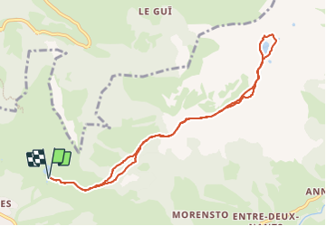

Length
9.6 km

Max alt
1980 m

Uphill gradient
282 m
Km-Effort
13.4 km

Min alt
1774 m

Downhill gradient
282 m
Boucle
Yes
Creation date :
2023-06-16 06:29:00.928
Updated on :
2023-06-16 10:04:45.72
3h35
Difficulty : Very easy

FREE GPS app for hiking
 SityTrail
IGN / Geographical institutes
SityTrail Plus
The world is yours!
About
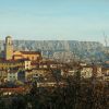
Trail Walking of 9.6 km to be discovered at Auvergne-Rhône-Alpes, Savoy, Hauteluce. This trail is proposed by anniediot.
Positioning
Country:
France
Region :
Auvergne-Rhône-Alpes
Department/Province :
Savoy
Municipality :
Hauteluce
Location:
Unknown
Start:(Dec)
Start:(UTM)
309661 ; 5070386 (32T) N.
Comments