


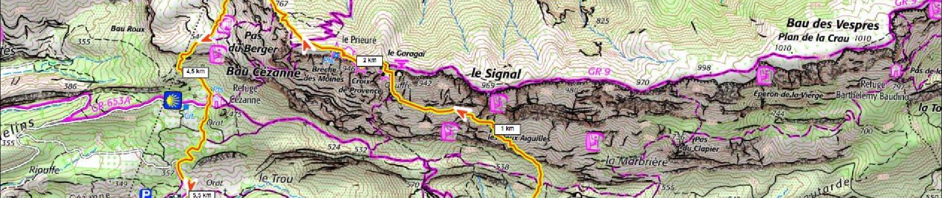
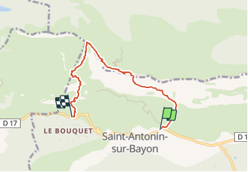
Ste Victoire par sentier noir 500m+ (dangereux)

ericberlin
User

Length
5.6 km

Max alt
909 m

Uphill gradient
465 m
Km-Effort
12.2 km

Min alt
310 m

Downhill gradient
597 m
Boucle
No
Creation date :
2023-06-16 15:02:16.406
Updated on :
2023-06-16 15:07:05.121
3h20
Difficulty : Very difficult

FREE GPS app for hiking
 SityTrail
IGN / Geographical institutes
SityTrail Plus
The world is yours!
About
Trail Walking of 5.6 km to be discovered at Provence-Alpes-Côte d'Azur, Bouches-du-Rhône, Saint-Antonin-sur-Bayon. This trail is proposed by ericberlin.
Photos
 - Photo 1")
Positioning
Country:
France
Region :
Provence-Alpes-Côte d'Azur
Department/Province :
Bouches-du-Rhône
Municipality :
Saint-Antonin-sur-Bayon
Location:
Unknown
Start:(Dec)
Start:(UTM)
709239 ; 4821926 (31T) N.
Comments