


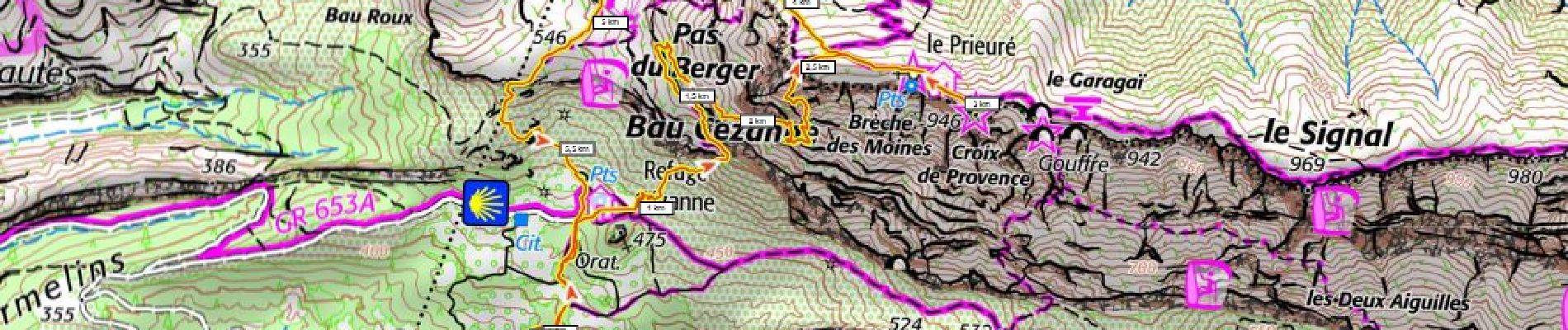
Ste Victoire, tracé jaune 600m+

ericberlin
User
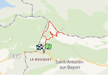

Length
6.5 km

Max alt
902 m

Uphill gradient
594 m
Km-Effort
14.4 km

Min alt
312 m

Downhill gradient
595 m
Boucle
Yes
Creation date :
2023-06-18 20:46:25.874
Updated on :
2023-06-18 20:53:34.826
3h16
Difficulty : Difficult

FREE GPS app for hiking
 SityTrail
IGN / Geographical institutes
SityTrail Plus
The world is yours!
About
Trail Walking of 6.5 km to be discovered at Provence-Alpes-Côte d'Azur, Bouches-du-Rhône, Saint-Antonin-sur-Bayon. This trail is proposed by ericberlin.
Photos

Positioning
Country:
France
Region :
Provence-Alpes-Côte d'Azur
Department/Province :
Bouches-du-Rhône
Municipality :
Saint-Antonin-sur-Bayon
Location:
Unknown
Start:(Dec)
Start:(UTM)
707523 ; 4822133 (31T) N.
Comments