


paulliles sud

JWeiszrock
User

Length
4.2 km

Max alt
77 m

Uphill gradient
96 m
Km-Effort
5.5 km

Min alt
0 m

Downhill gradient
96 m
Boucle
Yes
Creation date :
2023-06-21 12:21:58.485
Updated on :
2023-06-21 13:55:20.817
1h19
Difficulty : Easy

FREE GPS app for hiking
 SityTrail
IGN / Geographical institutes
SityTrail Plus
The world is yours!
About
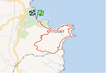
Trail Walking of 4.2 km to be discovered at Occitania, Pyrénées-Orientales, Port-Vendres. This trail is proposed by JWeiszrock.
Positioning
Country:
France
Region :
Occitania
Department/Province :
Pyrénées-Orientales
Municipality :
Port-Vendres
Location:
Unknown
Start:(Dec)
Start:(UTM)
510258 ; 4705506 (31T) N.
Comments