


Camps - Mercoeur

houbart
User
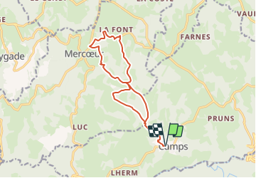

Length
14 km

Max alt
570 m

Uphill gradient
264 m
Km-Effort
17.5 km

Min alt
465 m

Downhill gradient
264 m
Boucle
Yes
Creation date :
2023-06-25 06:50:56.556
Updated on :
2023-06-28 14:03:45.707
3h58
Difficulty : Difficult

FREE GPS app for hiking
 SityTrail
IGN / Geographical institutes
SityTrail Plus
The world is yours!
About
Trail Walking of 14 km to be discovered at New Aquitaine, Corrèze, Camps-Saint-Mathurin-Léobazel. This trail is proposed by houbart.
Description
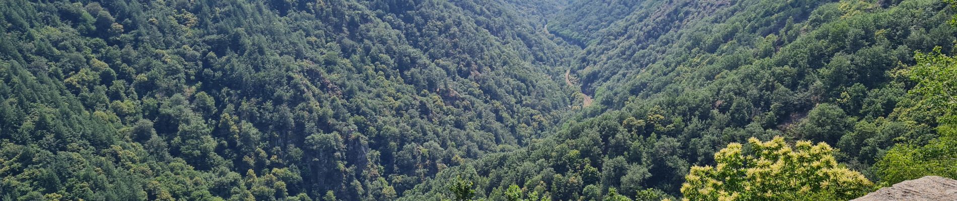
Après ou avant la rando, se rendre au Rocher du peintre, à 500 m du village. Vue sur les gorges de la Cère.
Photos


Positioning
Country:
France
Region :
New Aquitaine
Department/Province :
Corrèze
Municipality :
Camps-Saint-Mathurin-Léobazel
Location:
Unknown
Start:(Dec)
Start:(UTM)
420100 ; 4981583 (31T) N.
Comments