


Punta de tzan

marc radelet
User

Length
7.4 km

Max alt
3298 m

Uphill gradient
1095 m
Km-Effort
22 km

Min alt
2166 m

Downhill gradient
1125 m
Boucle
Yes
Creation date :
2023-06-25 05:28:57.0
Updated on :
2023-06-25 12:52:16.855
6h46
Difficulty : Very difficult

FREE GPS app for hiking
 SityTrail
IGN / Geographical institutes
SityTrail Plus
The world is yours!
About
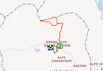
Trail Trail of 7.4 km to be discovered at Aosta Valley, Unknown, Torgnon. This trail is proposed by marc radelet.
Description
Alpinisme ne
Positioning
Country:
Italy
Region :
Aosta Valley
Department/Province :
Unknown
Municipality :
Torgnon
Location:
Unknown
Start:(Dec)
Start:(UTM)
388223 ; 5079829 (32T) N.
Comments