


lauchenkopf Lauchen

jcschubnel
User
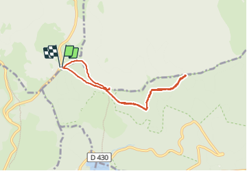

Length
6.5 km

Max alt
1271 m

Uphill gradient
165 m
Km-Effort
8.7 km

Min alt
1193 m

Downhill gradient
165 m
Boucle
Yes
Creation date :
2023-06-17 13:00:50.408
Updated on :
2023-06-26 16:00:16.019
2h28
Difficulty : Medium

FREE GPS app for hiking
 SityTrail
IGN / Geographical institutes
SityTrail Plus
The world is yours!
About
Trail Walking of 6.5 km to be discovered at Grand Est, Haut-Rhin, Metzeral. This trail is proposed by jcschubnel.
Positioning
Country:
France
Region :
Grand Est
Department/Province :
Haut-Rhin
Municipality :
Metzeral
Location:
Unknown
Start:(Dec)
Start:(UTM)
353207 ; 5312813 (32T) N.
Comments