![](/images/other/stat-length.png)
![Trail Walking Beauraing - Balade de Dion à Winenne - Beauraing - Photo](https://media.geolcdn.com/t/1900/400/ext.pjpeg?maxdim=2&url=https%3A%2F%2Fmedia.geolcdn.com%2Ff%2F5c1dc6e2-7e96-43cd-a912-ceabbaabe8bc.jpeg)
Balade de Dion à Winenne - Beauraing
Desrumaux
User GUIDE
![Length](/images/other/stat-length.png)
Length
6.5 km
![Max alt](https://static1.geolcdn.com/siteimages/upload/files/1508320355ic_sort_altitude_max_24dp.png)
Max alt
293 m
![Uphill gradient](https://static1.geolcdn.com/siteimages/upload/files/1508320355ic_sort_den_pos_24dp.png)
Uphill gradient
151 m
![Km-Effort](/images/other/stat-length.png)
Km-Effort
8.5 km
![Min alt](https://static1.geolcdn.com/siteimages/upload/files/1508320355ic_sort_altitude_min_24dp.png)
Min alt
172 m
![Downhill gradient](https://static1.geolcdn.com/siteimages/upload/files/1508320355ic_sort_den_neg_24dp.png)
Downhill gradient
147 m
![Boucle](https://static1.geolcdn.com/siteimages/upload/files/16400158638029165_repeat_loop_refresh_sync_direction_icon.png)
Boucle
Yes
Creation date :
2023-06-26 19:02:56.099
Updated on :
2023-06-27 05:29:34.705
![Walking](https://static1.geolcdn.com/sitytour/trail-icons/101.png)
1h55
Difficulty : Medium
![Scan this QR Code to open this trail in the SityTrail application](https://capi.geolives.com/qq0zvz2zws4bq2lad0pu/sitytour/trails/3713777/qr.png?size=200)
FREE GPS app for hiking
About
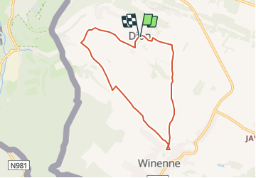
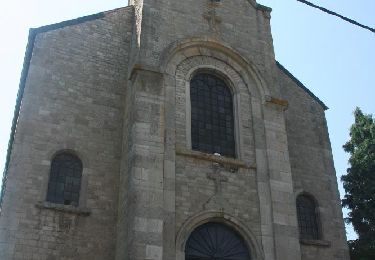
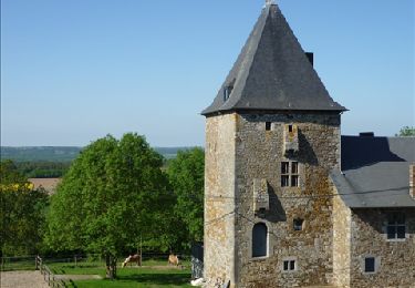
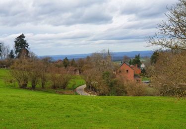
Trail Walking of 6.5 km to be discovered at Wallonia, Namur, Beauraing. This trail is proposed by Desrumaux.
Description
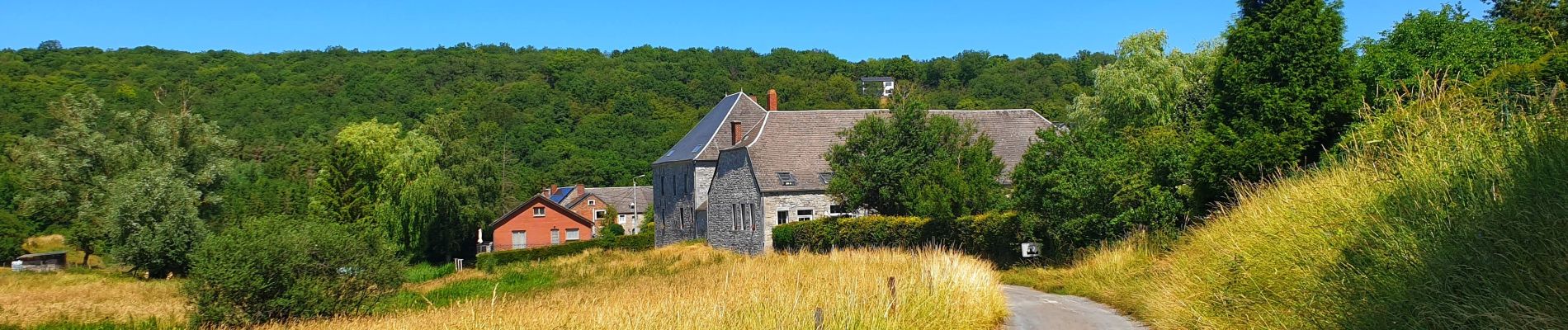
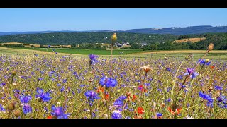
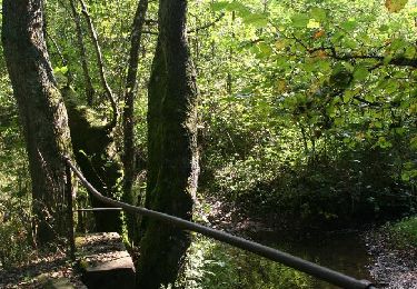
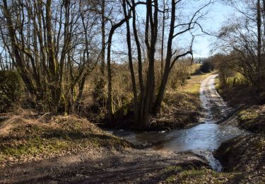
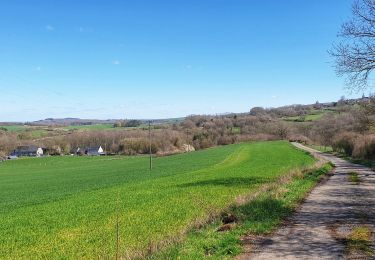
Jolie balade proposée par l'office du tourisme de Beauraing reliant le village de Dion au village de Winenne par d'agréables petites routes de campagne dans un décor typiquement famennois.
Balisage rectangle jaune numéroté 2
Positioning
Country:
Belgium
Region :
Wallonia
Department/Province :
Namur
Municipality :
Beauraing
Location:
Unknown
Start:(Dec)
Start:(UTM)
635015 ; 5553420 (31U) N.
Comments
Trails nearby
![Trail Walking Beauraing - Winenne - Nature: trip to the countryside - Photo](https://media.geolcdn.com/t/375/260/ext.jpg?maxdim=2&url=https%3A%2F%2Fservices.sitytrail.com%2FGeolivesWS%2FDownloadMedia.ashx%3FTrailID%3D208730%26Media%3Dec2b8399-61b2-47f0-8c4e-ffe9506b5f79.jpg)
![Walking Walking](https://static1.geolcdn.com/sitytour/trail-icons/101.png)
Winenne - Nature: trip to the countryside
Walking
Difficult
(7)
Beauraing,
Wallonia,
Namur,
Belgium
![](/images/other/stat-length.png)
20 km | 26 km-effort
6h 0min
![](https://static1.geolcdn.com/siteimages/upload/files/16400158638029165_repeat_loop_refresh_sync_direction_icon.png)
Yes
![Trail Walking Beauraing - RB-Na-28-En Famenne occidentale - Photo](https://media.geolcdn.com/t/375/260/ext.jpg?maxdim=2&url=https%3A%2F%2Fmedia.geolcdn.com%2Ff%2F3eaaa04f-7eff-4d10-b520-576c4173c26c.JPG)
![Walking Walking](https://static1.geolcdn.com/sitytour/trail-icons/101.png)
RB-Na-28-En Famenne occidentale
Walking
Very difficult
(5)
Beauraing,
Wallonia,
Namur,
Belgium
![](/images/other/stat-length.png)
19.4 km | 24 km-effort
5h 33min
![](https://static1.geolcdn.com/siteimages/upload/files/16400158638029165_repeat_loop_refresh_sync_direction_icon.png)
Yes
![Trail Walking Beauraing - Javingue-Sevry - Roadbook discovering villages & landscapes - Photo](https://media.geolcdn.com/t/375/260/ext.jpg?maxdim=2&url=https%3A%2F%2Fservices.sitytrail.com%2FGeolivesWS%2FDownloadMedia.ashx%3FTrailID%3D230063%26Media%3D65d10601-99c2-4ec7-afa5-e6b7caea9bd6.jpg)
![Walking Walking](https://static1.geolcdn.com/sitytour/trail-icons/101.png)
Javingue-Sevry - Roadbook discovering villages & landscapes
Walking
Easy
(6)
Beauraing,
Wallonia,
Namur,
Belgium
![](/images/other/stat-length.png)
7.7 km | 10.2 km-effort
2h 0min
![](https://static1.geolcdn.com/siteimages/upload/files/16400158638029165_repeat_loop_refresh_sync_direction_icon.png)
Yes
![Trail Walking Givet - Balade à Givet - Photo](https://media.geolcdn.com/t/375/260/ext.jpg?maxdim=2&url=https%3A%2F%2Fservices.sitytrail.com%2FGeolivesWS%2FDownloadMedia.ashx%3FTrailID%3D110616%26Media%3D6179_5.jpg)
![Walking Walking](https://static1.geolcdn.com/sitytour/trail-icons/101.png)
Balade à Givet
Walking
Medium
(3)
Givet,
Grand Est,
Ardennes,
France
![](/images/other/stat-length.png)
8 km | 9.4 km-effort
2h 0min
![](https://static1.geolcdn.com/siteimages/upload/files/16400158638029165_repeat_loop_refresh_sync_direction_icon.png)
Yes
![Trail Walking Givet - Promenade sur les remparts du Mont d'Haurs - Photo](https://media.geolcdn.com/t/375/260/ext.jpg?maxdim=2&url=https%3A%2F%2Fservices.sitytrail.com%2FGeolivesWS%2FDownloadMedia.ashx%3FTrailID%3D108905%26Media%3D2570_6.jpg)
![Walking Walking](https://static1.geolcdn.com/sitytour/trail-icons/101.png)
Promenade sur les remparts du Mont d'Haurs
Walking
Medium
(3)
Givet,
Grand Est,
Ardennes,
France
![](/images/other/stat-length.png)
5.1 km | 6.7 km-effort
2h 0min
![](https://static1.geolcdn.com/siteimages/upload/files/16400158638029165_repeat_loop_refresh_sync_direction_icon.png)
Yes
![Trail Mountain bike Beauraing - Winenne - Nature: trip to the countryside - Photo](https://media.geolcdn.com/t/375/260/ext.jpg?maxdim=2&url=https%3A%2F%2Fservices.sitytrail.com%2FGeolivesWS%2FDownloadMedia.ashx%3FTrailID%3D225225%26Media%3D30a4a7fc-abda-4afa-ad3f-06c878f2db6f.jpg)
![Mountain bike Mountain bike](https://static1.geolcdn.com/sitytour/trail-icons/202.png)
Winenne - Nature: trip to the countryside
Mountain bike
Medium
(3)
Beauraing,
Wallonia,
Namur,
Belgium
![](/images/other/stat-length.png)
20 km | 26 km-effort
1h 41min
![](https://static1.geolcdn.com/siteimages/upload/files/16400158638029165_repeat_loop_refresh_sync_direction_icon.png)
Yes
![Trail Walking Beauraing - Balade à Winenne - Beauraing - Photo](https://media.geolcdn.com/t/375/260/ext.jpg?maxdim=2&url=https%3A%2F%2Fmedia.geolcdn.com%2Ff%2F8bfd43ea-288d-45ae-81cb-56021fe3f6e3.jpeg)
![Walking Walking](https://static1.geolcdn.com/sitytour/trail-icons/101.png)
Balade à Winenne - Beauraing
Walking
Difficult
Beauraing,
Wallonia,
Namur,
Belgium
![](/images/other/stat-length.png)
11.7 km | 14.7 km-effort
3h 20min
![](https://static1.geolcdn.com/siteimages/upload/files/16400158638029165_repeat_loop_refresh_sync_direction_icon.png)
Yes
![Trail Walking Beauraing - Balade à Javingue-Sevry - Photo](https://media.geolcdn.com/t/375/260/ext.jpg?maxdim=2&url=https%3A%2F%2Fmedia.geolcdn.com%2Ff%2F60dbfcb3-e867-4480-b101-a047b64bbff2.jpeg)
![Walking Walking](https://static1.geolcdn.com/sitytour/trail-icons/101.png)
Balade à Javingue-Sevry
Walking
Difficult
Beauraing,
Wallonia,
Namur,
Belgium
![](/images/other/stat-length.png)
9.5 km | 12.4 km-effort
2h 49min
![](https://static1.geolcdn.com/siteimages/upload/files/16400158638029165_repeat_loop_refresh_sync_direction_icon.png)
Yes
![Trail Walking Beauraing - Beauraing Aire d'envol - Photo](https://media.geolcdn.com/t/375/260/ext.jpg?maxdim=2&url=https%3A%2F%2Fstatic1.geolcdn.com%2Fsiteimages%2Fupload%2Ffiles%2F1553511878bg_sport_marche.png)
![Walking Walking](https://static1.geolcdn.com/sitytour/trail-icons/101.png)
Beauraing Aire d'envol
Walking
Very easy
(1)
Beauraing,
Wallonia,
Namur,
Belgium
![](/images/other/stat-length.png)
12.8 km | 16.8 km-effort
3h 3min
![](https://static1.geolcdn.com/siteimages/upload/files/16400158638029165_repeat_loop_refresh_sync_direction_icon.png)
Yes