


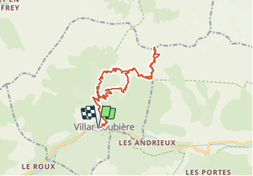
Villar Loubière Pic Turbat

Jack29
User

Length
22 km

Max alt
2987 m

Uphill gradient
2017 m
Km-Effort
49 km

Min alt
1022 m

Downhill gradient
2015 m
Boucle
Yes
Creation date :
2023-06-28 03:24:43.859
Updated on :
2023-06-28 18:10:36.569
14h42
Difficulty : Very difficult

FREE GPS app for hiking
 SityTrail
IGN / Geographical institutes
SityTrail Plus
The world is yours!
About
Trail Walking of 22 km to be discovered at Provence-Alpes-Côte d'Azur, Hautes-Alpes, Villar-Loubière. This trail is proposed by Jack29.
Positioning
Country:
France
Region :
Provence-Alpes-Côte d'Azur
Department/Province :
Hautes-Alpes
Municipality :
Villar-Loubière
Location:
Unknown
Start:(Dec)
Start:(UTM)
274101 ; 4967516 (32T) N.
Comments