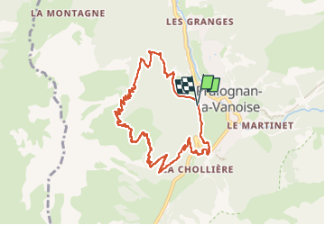
Trail Walking Pralognan-la-Vanoise - col de napremont - Photo
 amiral13
amiral13

User GUIDE

© OpenStreetMap contributors
Length
Length
9.4 km
Max alt
Max alt
2162 m
Uphill gradient
Uphill gradient
749 m
Km-Effort
Km-Effort  
19.4 km
Min alt
Min alt
1414 m
Downhill gradient
Downhill gradient
745 m
Boucle
Boucle
Yes
Creation date :
2023-07-02 08:30:14.44
Updated on :
2024-04-17 17:04:34.854

(0 Reviews)

Walking
Walking
4h24
Difficulty : Easy

Scan this QR Code to open this trail in the SityTrail application

FREE GPS app for hiking

Logo SityTrail SityTrail

IGN / Geographical institutes

Download SityTrail from the App Store Download SityTrail from Google Play

Logo SityTrail SityTrail Plus

The world is yours!

Download SityTrail from the App Store Download SityTrail from Google Play Download SityTrail on Huawei AppGallery

About

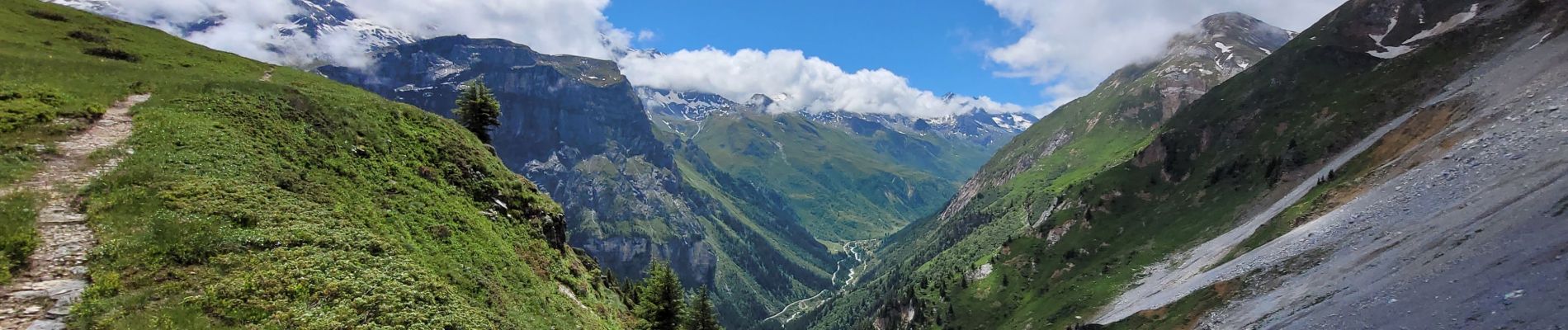
Trail Walking of 9.4 km to be discovered at Auvergne-Rhône-Alpes, Savoy, Pralognan-la-Vanoise. This trail is proposed by amiral13.

Description

randonnée effectuée le 2 juillet 2023
pour ceux qui sont sensibles au vertiges privilégiez le sens inverse de la randonnée de manière à monter les escaliers plutôt que de les descendre.
C'est un beau belvédère sur la Grande Casse malheureusement pour nous elle est restée dans son écrin de nuage toute la journée ; tout comme la Portetta et le grand bec.

Elevation profile

Photos

Positioning

Country:
France
Region :
Auvergne-Rhône-Alpes
Department/Province :
Savoy
Municipality :
Pralognan-la-Vanoise
Location:
Unknown
Start:(UTM)
321139 ; 5027825 (32T) N.


Close
My subscriptions