Trail Walking Pralognan-la-Vanoise - le lac de la patinoire - Photo
 amiral13
amiral13

User GUIDE

© OpenStreetMap contributors
Length
Length
11.3 km
Max alt
Max alt
2576 m
Uphill gradient
Uphill gradient
813 m
Km-Effort
Km-Effort  
22 km
Min alt
Min alt
1879 m
Downhill gradient
Downhill gradient
809 m
Boucle
Boucle
Yes
Creation date :
2023-07-03 08:15:34.667
Updated on :
2023-07-03 15:29:52.891

(0 Reviews)

Walking
Walking
5h40
Difficulty : Difficult

Scan this QR Code to open this trail in the SityTrail application

FREE GPS app for hiking

Logo SityTrail SityTrail

IGN / Geographical institutes

Download SityTrail from the App Store Download SityTrail from Google Play

Logo SityTrail SityTrail Plus

The world is yours!

Download SityTrail from the App Store Download SityTrail from Google Play Download SityTrail on Huawei AppGallery

About

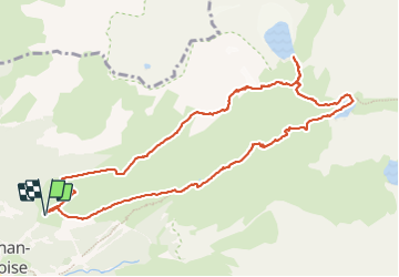
Trail Walking of 11.3 km to be discovered at Auvergne-Rhône-Alpes, Savoy, Pralognan-la-Vanoise. This trail is proposed by amiral13.

Description

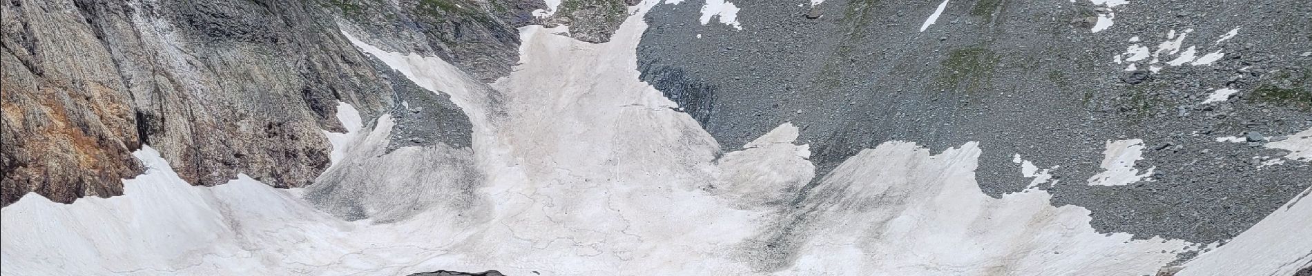
rando effectuée le 3 juillet 2023 attention en début de saison
la présence de névés à la descente du col Rosset peut rendre le passage impossible sans équipements spéciaux (crampons). pour nous la neige était à point vers midi et les campons sont restés dans le sac; ils étaient vivement conseillé par le bureau des guides. la descente peut être écourtée mais le passage du lac des vaches vaut le détour.

Elevation profile

Photos

Positioning

Country:
France
Region :
Auvergne-Rhône-Alpes
Department/Province :
Savoy
Municipality :
Pralognan-la-Vanoise
Location:
Unknown
Start:(UTM)
322314 ; 5028382 (32T) N.


Close
My subscriptions