Champoléon - Refuge de tourond - Cascade de la Pisse

frizou83
User
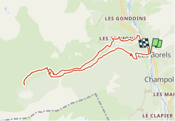

Length
10.1 km

Max alt
1849 m

Uphill gradient
591 m
Km-Effort
18 km

Min alt
1271 m

Downhill gradient
592 m
Boucle
Yes
Creation date :
2023-07-11 13:36:25.872
Updated on :
2023-07-11 13:45:08.727
4h05
Difficulty : Difficult

FREE GPS app for hiking
 SityTrail
IGN / Geographical institutes
SityTrail Plus
The world is yours!
About
Trail Walking of 10.1 km to be discovered at Provence-Alpes-Côte d'Azur, Hautes-Alpes, Champoléon. This trail is proposed by frizou83.
Positioning
Country:
France
Region :
Provence-Alpes-Côte d'Azur
Department/Province :
Hautes-Alpes
Municipality :
Champoléon
Location:
Unknown
Start:(Dec)
Start:(UTM)
282876 ; 4955559 (32T) N.
Comments