


Plateau de Bure

alain12
User
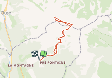

Length
17.8 km

Max alt
2562 m

Uphill gradient
1277 m
Km-Effort
35 km

Min alt
1442 m

Downhill gradient
1277 m
Boucle
Yes
Creation date :
2023-07-09 07:45:40.86
Updated on :
2023-07-14 12:17:59.511
122h23
Difficulty : Very difficult

FREE GPS app for hiking
 SityTrail
IGN / Geographical institutes
SityTrail Plus
The world is yours!
About
Trail Walking of 17.8 km to be discovered at Provence-Alpes-Côte d'Azur, Hautes-Alpes, Montmaur. This trail is proposed by alain12.
Positioning
Country:
France
Region :
Provence-Alpes-Côte d'Azur
Department/Province :
Hautes-Alpes
Municipality :
Montmaur
Location:
Unknown
Start:(Dec)
Start:(UTM)
729238 ; 4942789 (31T) N.
Comments