Montmaur, Hautes-Alpes: Best trails, routes and walks

4 comments

Montmaur: Discover the best trails: 48 hiking trails, 4 bike and mountain-bike routes and 1 equestrian circuits. All these trails, routes and outdoor activities are available in our SityTrail applications for smartphones and tablets.


The best trails (54)

Trail Walking Montmaur - Montmaur Le Terrail - Photo
Walking 5.263
Km

Walking

Easy
(1)
Montmaur, Provence-Alpes-Côte d'Azur, Hautes-Alpes, France
5.3 km | 6.2 km-effort
1h 22min
68 m
66 m
Yes
Marco05

Trail Mountain bike Montmaur - VTT28 - Rabioux - Photo
Mountain bike 23.761
Km
GUIDE+

Mountain bike

Difficult
Montmaur, Provence-Alpes-Côte d'Azur, Hautes-Alpes, France
24 km | 36 km-effort
2h 12min
897 m
896 m
Yes
Camping Les Rives du Lac

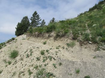
• "Effective" hike: Fast climb by the road of the Col du Festre, very rolling forest road from the Cluse. Then beautifu...

Trail Walking Montmaur - R23   Observation des Chamois - Photo
Walking 4.556
Km
GUIDE+

Walking

Medium
Montmaur, Provence-Alpes-Côte d'Azur, Hautes-Alpes, France
4.6 km | 9.3 km-effort
1h 56min
356 m
357 m
Yes
Camping Les Rives du Lac

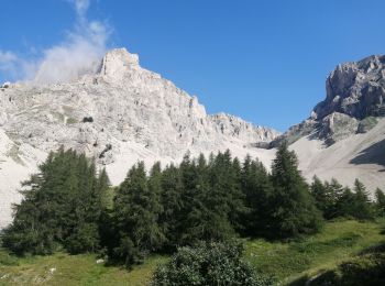
• This itinerary is to be done at the end of the day, when the chamois come to enjoy the last rays of sun. Or in the m...
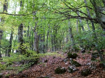
Trail Walking Montmaur - R18   Le Pic de Bure - Photo
Walking 13.77
Km
GUIDE+

Walking

Very difficult
Montmaur, Provence-Alpes-Côte d'Azur, Hautes-Alpes, France
13.8 km | 33 km-effort
6h 20min
1409 m
1430 m
Yes
Camping Les Rives du Lac

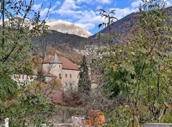
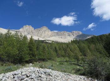
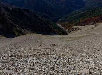
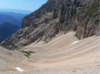
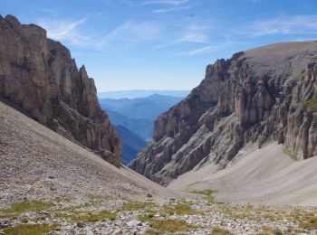
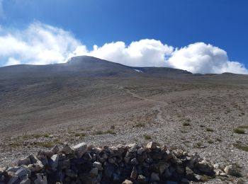
• The mythical hike of the region. Very long but not involving technical difficulty. The plateau of Bure, lunar, is imp...

Trail Walking Montmaur - Dévoluy - Pic de Bure - Photo
Walking 14.578
Km

Walking

Very difficult
(1)
Montmaur, Provence-Alpes-Côte d'Azur, Hautes-Alpes, France
14.6 km | 33 km-effort
8h 20min
1376 m
1376 m
Yes
jujube007

Trail Walking Montmaur - Pic et observatoire de BURE - Photo
Walking 22.426
Km
GUIDE

Walking

Difficult
(1)
Montmaur, Provence-Alpes-Côte d'Azur, Hautes-Alpes, France
22 km | 58 km-effort
4h 59min
2647 m
2642 m
Yes
R@ph

Trail Walking Montmaur - Les Sauvas - Photo
Walking 12.949
Km

Walking

Medium
Montmaur, Provence-Alpes-Côte d'Azur, Hautes-Alpes, France
12.9 km | 21 km-effort
4h 42min
583 m
585 m
Yes
Marco05

Trail Walking Montmaur - Pic de bure - Photo
Walking 13.564
Km

Walking

Very difficult
Montmaur, Provence-Alpes-Côte d'Azur, Hautes-Alpes, France
13.6 km | 31 km-effort
7h 8min
1340 m
1335 m
Yes
Vero7684

Trail Walking Montmaur - Pic de Bure par combe d'Aurouze - Photo
Walking 14.087
Km

Walking

Very difficult
Montmaur, Provence-Alpes-Côte d'Azur, Hautes-Alpes, France
14.1 km | 33 km-effort
7h 24min
1388 m
1388 m
Yes
Marco05

Trail Walking Montmaur - Col de Conode - Photo
Walking 14.244
Km

Walking

Medium
Montmaur, Provence-Alpes-Côte d'Azur, Hautes-Alpes, France
14.2 km | 22 km-effort
4h 58min
573 m
573 m
Yes
Marco05

Trail Walking Montmaur - pic de bure  - Photo
Walking 17.356
Km

Walking

Difficult
Montmaur, Provence-Alpes-Côte d'Azur, Hautes-Alpes, France
17.4 km | 0 m-effort
8h 4min
0 m
0 m
Yes
Joel26400

Trail Walking Montmaur - tentative de la tête du Prad Arnaud - Photo
Walking 9.644
Km

Walking

Very difficult
Montmaur, Provence-Alpes-Côte d'Azur, Hautes-Alpes, France
9.6 km | 22 km-effort
6h 32min
916 m
912 m
Yes
nadd73

Trail Walking Montmaur - du gîte ONF des Sauvas au gîte ONF de Chaudin  - Photo
Walking 19.289
Km

Walking

Difficult
Montmaur, Provence-Alpes-Côte d'Azur, Hautes-Alpes, France
19.3 km | 30 km-effort
6h 9min
781 m
809 m
No
destras

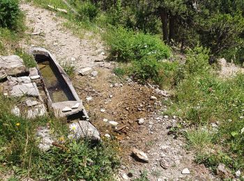
• Etape la plus belle et la plus variée par les cols de Matacharre et Conode, la chapelle de la Crotte à travers des mé...

Trail Walking Montmaur - Pic de Bure par Pré la Pare - Photo
Walking 13.765
Km

Walking

Difficult
Montmaur, Provence-Alpes-Côte d'Azur, Hautes-Alpes, France
13.8 km | 32 km-effort
6h 20min
1338 m
1349 m
Yes
Dervalmarc

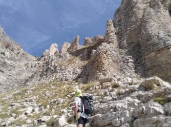
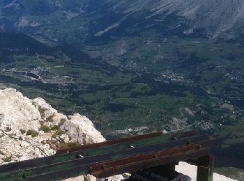
• Randonnée très sportive à n'entreprendre que par beau temps . Plusieurs passages délicat n'ecessitant l'usage des mai...

Trail Walking Montmaur - Pic et observatoire de Bure - Photo
Walking 13.529
Km

Walking

Difficult
Montmaur, Provence-Alpes-Côte d'Azur, Hautes-Alpes, France
13.5 km | 32 km-effort
7h 0min
1395 m
1395 m
Yes
tracegps

Trail Mountain bike Montmaur - Grande Traversée des PréAlpes à VTT : La Montagne - La Roche des Arnauds - Photo
Mountain bike 23.999
Km

Mountain bike

Difficult
Montmaur, Provence-Alpes-Côte d'Azur, Hautes-Alpes, France
24 km | 34 km-effort
2h 30min
671 m
1015 m
No
tracegps

Trail Walking Montmaur - Boucle Mgn de Montmaur vers M.F.de Rabiou - Photo
Walking 6.297
Km

Walking

Medium
Montmaur, Provence-Alpes-Côte d'Azur, Hautes-Alpes, France
6.3 km | 9.1 km-effort
2h 4min
212 m
209 m
Yes
rigol05

Trail Walking Montmaur - Autour de Trésaubenq - Photo
Walking 10.485
Km

Walking

Difficult
Montmaur, Provence-Alpes-Côte d'Azur, Hautes-Alpes, France
10.5 km | 15.3 km-effort
3h 28min
358 m
358 m
Yes
rigol05

Trail On foot Montmaur - Pic de Bure depart les Sauvas  1335 + - Photo
On foot 6.582
Km

On foot

Easy
Montmaur, Provence-Alpes-Côte d'Azur, Hautes-Alpes, France
6.6 km | 20 km-effort
4h 32min
1335 m
20 m
No
claude nier

Trail Trail Montmaur - col de matachar - Photo
Trail 17.306
Km

Trail

Medium
Montmaur, Provence-Alpes-Côte d'Azur, Hautes-Alpes, France
17.3 km | 29 km-effort
8h 7min
887 m
863 m
No
Katalin Van Hecke

20 trails displayed on 54

FREE GPS app for hiking

Logo SityTrail SityTrail

IGN / Geographical institutes

Download SityTrail from the App Store Download SityTrail from Google Play

Logo SityTrail SityTrail World

The world is yours!

Download SityTrail from the App Store Download SityTrail from Google Play Download SityTrail on Huawei AppGallery

Activities

Close
My subscriptions