


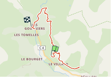
Les gourniers3

nathr
User

Length
9.1 km

Max alt
1856 m

Uphill gradient
590 m
Km-Effort
17 km

Min alt
1470 m

Downhill gradient
589 m
Boucle
No
Creation date :
2023-07-15 08:45:21.74
Updated on :
2023-07-15 11:15:53.448
2h30
Difficulty : Medium

FREE GPS app for hiking
 SityTrail
IGN / Geographical institutes
SityTrail Plus
The world is yours!
About
Trail Walking of 9.1 km to be discovered at Provence-Alpes-Côte d'Azur, Hautes-Alpes, Réallon. This trail is proposed by nathr.
Positioning
Country:
France
Region :
Provence-Alpes-Côte d'Azur
Department/Province :
Hautes-Alpes
Municipality :
Réallon
Location:
Unknown
Start:(Dec)
Start:(UTM)
289175 ; 4942425 (32T) N.
Comments