


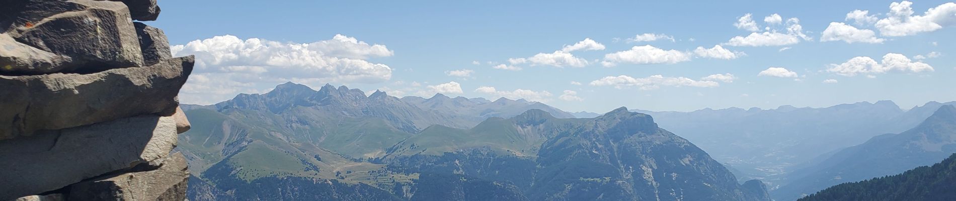
St Vincent les forts montagnette

Danielba
User GUIDE
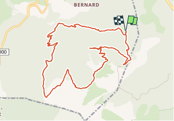

Length
13.7 km

Max alt
2263 m

Uphill gradient
978 m
Km-Effort
27 km

Min alt
1412 m

Downhill gradient
975 m
Boucle
Yes
Creation date :
2023-07-16 06:25:36.999
Updated on :
2023-07-16 17:19:37.508
8h17
Difficulty : Difficult

FREE GPS app for hiking
 SityTrail
IGN / Geographical institutes
SityTrail Plus
The world is yours!
About
Trail Walking of 13.7 km to be discovered at Provence-Alpes-Côte d'Azur, Alpes-de-Haute-Provence, Ubaye-Serre-Ponçon. This trail is proposed by Danielba .
Photos


Positioning
Country:
France
Region :
Provence-Alpes-Côte d'Azur
Department/Province :
Alpes-de-Haute-Provence
Municipality :
Ubaye-Serre-Ponçon
Location:
Saint-Vincent-les-Forts
Start:(Dec)
Start:(UTM)
293138 ; 4923150 (32T) N.
Comments