


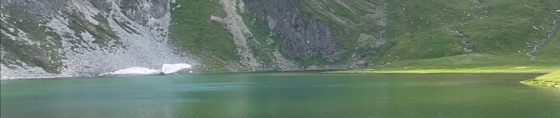
Tignes Le Lac -> Lac de Chardonnet

CooolGeorges
User
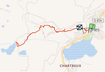

Length
5 km

Max alt
2391 m

Uphill gradient
315 m
Km-Effort
9.2 km

Min alt
2093 m

Downhill gradient
303 m
Boucle
Yes
Creation date :
2023-07-19 11:33:38.0
Updated on :
2023-07-19 13:59:16.126
2h25
Difficulty : Medium

FREE GPS app for hiking
 SityTrail
IGN / Geographical institutes
SityTrail Plus
The world is yours!
About
Trail Walking of 5 km to be discovered at Auvergne-Rhône-Alpes, Savoy, Tignes. This trail is proposed by CooolGeorges.
Photos

Positioning
Country:
France
Region :
Auvergne-Rhône-Alpes
Department/Province :
Savoy
Municipality :
Tignes
Location:
Unknown
Start:(Dec)
Start:(UTM)
336338 ; 5037187 (32T) N.
Comments