Trail Walking Saint-Martin-en-Bresse - G . La Madeleine - Les Marlins - La Foret - Colnand - Bellefond - et retour  - Photo

G . La Madeleine - Les Marlins - La Foret - Colnand - Bellefond - et retour

© OpenStreetMap contributors
Length
Length
13.4 km
Max alt
Max alt
224 m
Uphill gradient
Uphill gradient
109 m
Km-Effort
Km-Effort  
14.8 km
Min alt
Min alt
198 m
Downhill gradient
Downhill gradient
110 m
Boucle
Boucle
Yes
Creation date :
2023-07-24 10:20:23.499
Updated on :
2023-07-24 10:33:42.841

(0 Reviews)

Walking
Walking
3h22
Difficulty : Difficult

Scan this QR Code to open this trail in the SityTrail application

FREE GPS app for hiking

Logo SityTrail SityTrail

IGN / Geographical institutes

Download SityTrail from the App Store Download SityTrail from Google Play

Logo SityTrail SityTrail World

The world is yours!

Download SityTrail from the App Store Download SityTrail from Google Play Download SityTrail on Huawei AppGallery

About

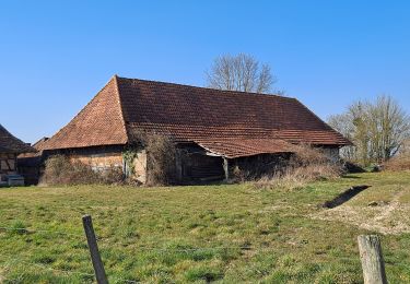
Trail Walking of 13.4 km to be discovered at Bourgogne-Franche-Comté, Saône-et-Loire, Saint-Martin-en-Bresse. This trail is proposed by jeanpaulcheyssac.

Description

Départ : Parking à proximité monument aux morts de La Madeleine .

Elevation profile

Positioning

Country:
France
Region :
Bourgogne-Franche-Comté
Department/Province :
Saône-et-Loire
Municipality :
Saint-Martin-en-Bresse
Location:
Unknown
Start:(UTM)
657195 ; 5180969 (31T) N.

Trails nearby

Trail Walking Lessard-en-Bresse - mesnay confiture - Photo
Walking
claudia71440

Walking

Easy
Lessard-en-Bresse, Bourgogne-Franche-Comté, Saône-et-Loire, France
65 km | 78 km-effort
2h 52min
No
Trail Hybrid bike Diconne - Les Jacquards  - Photo
Hybrid bike
mallovon

Hybrid bike

Very easy
Diconne, Bourgogne-Franche-Comté, Saône-et-Loire, France
5.6 km | 6.1 km-effort
44min
Yes
Trail Electric bike Saint-Martin-en-Bresse - St Martin en Bresse - Verdun sur le Doubs - Chalon sur Sâone - Photo
Electric bike
JackyCouturier

Electric bike

Easy
Saint-Martin-en-Bresse, Bourgogne-Franche-Comté, Saône-et-Loire, France
63 km | 68 km-effort
Unknown
Yes
Trail On foot Tronchy - P . Tronchy - Les Cottins - La Vendue - Les Vallots - Abbaye des Barres - Le GD Creuilly et retour .  - Photo
On foot
jeanpaulcheyssac

On foot

Easy
Tronchy, Bourgogne-Franche-Comté, Saône-et-Loire, France
9.6 km | 10.9 km-effort
2h 28min
Yes
Trail On foot Tronchy - P . Tronchy - Etang EDF - Le GD Creuilliy- Abbaye des Barres - Les Vallots et retour au Cottins  - Photo
On foot
jeanpaulcheyssac

On foot

Easy
Tronchy, Bourgogne-Franche-Comté, Saône-et-Loire, France
6.9 km | 8 km-effort
1h 48min
Yes
Trail On foot L'Abergement-Sainte-Colombe - P . L' abergement St Colombe - Les cfoix Jean - Foichot - Boullerand - Abbaye des Barres - Le Charmois et retour par Le Champ salin .  - Photo
On foot
jeanpaulcheyssac

On foot

Easy
L'Abergement-Sainte-Colombe, Bourgogne-Franche-Comté, Saône-et-Loire, France
8.5 km | 9.3 km-effort
2h 6min
Yes
Trail Walking Montcoy - P . Montcoy - Les Genettes - Bois de la mousse- Orain - Bey - Le Pommeray - Champ Failly et retour .  - Photo
Walking
jeanpaulcheyssac

Walking

Medium
Montcoy, Bourgogne-Franche-Comté, Saône-et-Loire, France
9.3 km | 10.3 km-effort
2h 20min
Yes
Trail Walking Tronchy - G . Tronchy - Etang Gilet - Les Vallots - Corberan - Le Villey - Les moissons - La Coudre et retour .  - Photo
Walking
jeanpaulcheyssac

Walking

Medium
Tronchy, Bourgogne-Franche-Comté, Saône-et-Loire, France
10.5 km | 11.8 km-effort
2h 40min
Yes
Trail Walking L'Abergement-Sainte-Colombe - G . L' Abergement St Colombe - Les Clousiaux - étang du Timon - Les Montmorts - La Gd Taule - Les Leys et retour .  - Photo
Walking
jeanpaulcheyssac

Walking

Medium
L'Abergement-Sainte-Colombe, Bourgogne-Franche-Comté, Saône-et-Loire, France
9.9 km | 11.1 km-effort
2h 31min
Yes


Close
My subscriptions