


Le Puig Carlit

cron
User

Length
13.8 km

Max alt
2886 m

Uphill gradient
922 m
Km-Effort
26 km

Min alt
2003 m

Downhill gradient
921 m
Boucle
Yes
Creation date :
2023-07-24 14:54:30.455
Updated on :
2023-07-24 14:56:06.937
5h56
Difficulty : Very difficult

FREE GPS app for hiking
 SityTrail
IGN / Geographical institutes
SityTrail Plus
The world is yours!
About
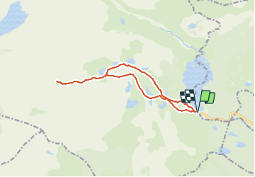
Trail Walking of 13.8 km to be discovered at Occitania, Pyrénées-Orientales, Angoustrine-Villeneuve-des-Escaldes. This trail is proposed by cron.
Description
Départ : parking des Bouillouses
Positioning
Country:
France
Region :
Occitania
Department/Province :
Pyrénées-Orientales
Municipality :
Angoustrine-Villeneuve-des-Escaldes
Location:
Unknown
Start:(Dec)
Start:(UTM)
417924 ; 4712381 (31T) N.
Comments