


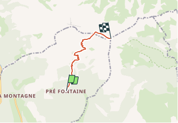
Pic de Bure depart les Sauvas 1335 +

claude nier
User

Length
6.6 km

Max alt
2696 m

Uphill gradient
1335 m
Km-Effort
20 km

Min alt
1347 m

Downhill gradient
20 m
Boucle
No
Creation date :
2023-07-26 14:07:57.095
Updated on :
2023-07-26 14:09:17.535
4h32
Difficulty : Easy

FREE GPS app for hiking
 SityTrail
IGN / Geographical institutes
SityTrail Plus
The world is yours!
About
Trail On foot of 6.6 km to be discovered at Provence-Alpes-Côte d'Azur, Hautes-Alpes, Montmaur. This trail is proposed by claude nier.
Description
Belle rando....il y a longtemps....a refaire
Positioning
Country:
France
Region :
Provence-Alpes-Côte d'Azur
Department/Province :
Hautes-Alpes
Municipality :
Montmaur
Location:
Unknown
Start:(Dec)
Start:(UTM)
730458 ; 4942691 (31T) N.
Comments