Trail Walking Colmar - balade découverte de Colmar  - Photo

balade découverte de Colmar

© OpenStreetMap contributors
Length
Length
6.4 km
Max alt
Max alt
202 m
Uphill gradient
Uphill gradient
44 m
Km-Effort
Km-Effort  
7 km
Min alt
Min alt
188 m
Downhill gradient
Downhill gradient
43 m
Boucle
Boucle
Yes
Creation date :
2023-07-17 12:36:20.569
Updated on :
2023-07-31 08:16:18.437

(0 Reviews)

Walking
Walking
2h50
Difficulty : Very easy

Scan this QR Code to open this trail in the SityTrail application

FREE GPS app for hiking

Logo SityTrail SityTrail

IGN / Geographical institutes

Download SityTrail from the App Store Download SityTrail from Google Play

Logo SityTrail SityTrail World

The world is yours!

Download SityTrail from the App Store Download SityTrail from Google Play Download SityTrail on Huawei AppGallery

About

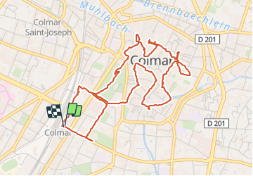
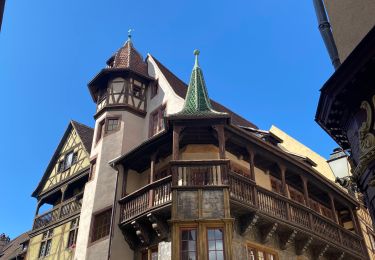
Trail Walking of 6.4 km to be discovered at Grand Est, Haut-Rhin, Colmar. This trail is proposed by Godasses et Grosses Pattes.

Description

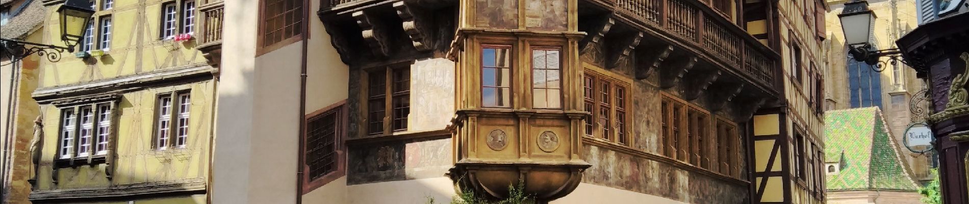
boucle pour découvrir Colmar
et stationnement au parking de la gare du nord (payant du lundi au samedi de 9h-19h 1,90 de l'heure)

Elevation profile

Photos

Positioning

Country:
France
Region :
Grand Est
Department/Province :
Haut-Rhin
Municipality :
Colmar
Location:
Unknown
Start:(UTM)
376893 ; 5325667 (32U) N.

Trails nearby

Trail Walking Eguisheim - suuntoapp-Hiking-2023-12-29T09-05-16Z - Photo
Walking
GUIDE
holtzv

Walking

Medium
Eguisheim, Grand Est, Haut-Rhin, France
22 km | 32 km-effort
7h 16min
Yes
Trail Running Colmar - Covid-19 - A la recherche du cercle parfait - Photo
Running
zazie

Running

Very easy
(1)
Colmar, Grand Est, Haut-Rhin, France
11.2 km | 11.9 km-effort
1h 0min
Yes
Trail Walking Colmar - grand tour de Colmar - Photo
Walking
Domdomii

Walking

Very easy
(1)
Colmar, Grand Est, Haut-Rhin, France
4.7 km | 5.1 km-effort
1h 22min
Yes
Trail Walking Husseren-les-Châteaux - Husseren les Châteaux - Photo
Walking
oscar1

Walking

Easy
Husseren-les-Châteaux, Grand Est, Haut-Rhin, France
12.7 km | 19.1 km-effort
3h 24min
Yes
Trail Road bike Turckheim - Véloroute du vignoble - Photo
Road bike
apa

Road bike

Medium
Turckheim, Grand Est, Haut-Rhin, France
55 km | 61 km-effort
3h 31min
No
Trail Walking Colmar - Colmar petite Venise  - Photo
Walking
FOUCAULT

Walking

Colmar, Grand Est, Haut-Rhin, France
9.3 km | 10.1 km-effort
3h 16min
Yes
Trail Walking Eguisheim - Rando des cinq châteaux  - Photo
Walking
Koralie Werny

Walking

Medium
Eguisheim, Grand Est, Haut-Rhin, France
18.4 km | 28 km-effort
5h 19min
Yes
Trail Walking Katzenthal - boucle katzenthal- galtz- 3 épis- katzenthal  - Photo
Walking
fbienmuller

Walking

Difficult
(1)
Katzenthal, Grand Est, Haut-Rhin, France
12.2 km | 19.3 km-effort
3h 48min
Yes
Trail Walking Colmar - Sur un parcours d'une course d'orientation  - Photo
Walking
zazie

Walking

Very easy
Colmar, Grand Est, Haut-Rhin, France
4.6 km | 5 km-effort
51min
No


Close
My subscriptions