Trail Walking Saint-Chaffrey - Croix de la Cime sur la Crête de Peyrolle - Photo

Croix de la Cime sur la Crête de Peyrolle

© OpenStreetMap contributors
Length
Length
6.3 km
Max alt
Max alt
2589 m
Uphill gradient
Uphill gradient
304 m
Km-Effort
Km-Effort  
10.4 km
Min alt
Min alt
2376 m
Downhill gradient
Downhill gradient
307 m
Boucle
Boucle
Yes
Creation date :
2023-07-30 08:07:42.337
Updated on :
2023-08-07 15:44:27.297

(0 Reviews)

Walking
Walking
5h15
Difficulty : Medium

Scan this QR Code to open this trail in the SityTrail application

FREE GPS app for hiking

Logo SityTrail SityTrail

IGN / Geographical institutes

Download SityTrail from the App Store Download SityTrail from Google Play

Logo SityTrail SityTrail World

The world is yours!

Download SityTrail from the App Store Download SityTrail from Google Play Download SityTrail on Huawei AppGallery

About

Trail Walking of 6.3 km to be discovered at Provence-Alpes-Côte d'Azur, Hautes-Alpes, Saint-Chaffrey. This trail is proposed by GuyVachet.

Description

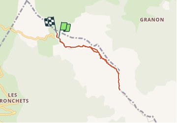
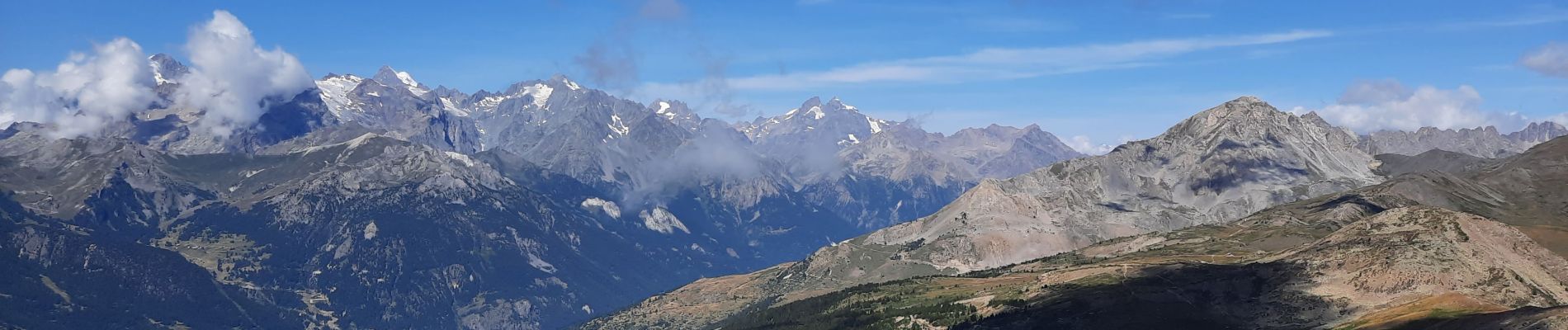
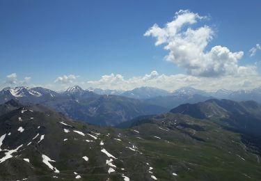
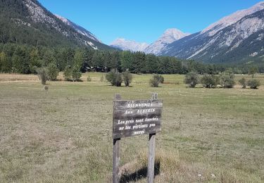
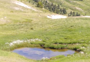
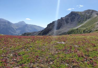
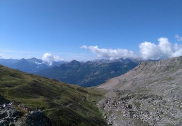
Aller-Retour pour parcourir en partie la Crête de Peyrolle jusqu'à la Croix de la Cime par la variante du GR 5C. Au départ du Col de Granon, il faut absolument profiter de la vue sur la Meije, sur la Barre et le Dôme des Écrins et sur le Pelvoux. Le Col de Barteaux est atteint facilement puis il faut monter de 200m pour prendre pied sur la crête. Le parcours sans être dangereux peut être impressionnant pour certains et l'arrivée à la croix permet d'avoir un panorama complet. La descente s'effectue par le même itinéraire.

Elevation profile

Photos

Positioning

Country:
France
Region :
Provence-Alpes-Côte d'Azur
Department/Province :
Hautes-Alpes
Municipality :
Saint-Chaffrey
Location:
Unknown
Start:(UTM)
311658 ; 4981505 (32T) N.

Trails nearby

Trail Mountain bike Val-des-Prés - Montgenèvre et col de la Lauze - Photo
Mountain bike
tracegps

Mountain bike

Very difficult
(1)
Val-des-Prés, Provence-Alpes-Côte d'Azur, Hautes-Alpes, France
38 km | 57 km-effort
3h 30min
Yes
Trail Walking La Salle-les-Alpes - le grand Aréa (boucle) - Photo
Walking
GUIDE
amiral13

Walking

Medium
La Salle-les-Alpes, Provence-Alpes-Côte d'Azur, Hautes-Alpes, France
7.7 km | 17.1 km-effort
4h 49min
Yes
Trail Walking La Salle-les-Alpes - Grand AREA 21/06/18 - Photo
Walking
GUIDE
R@ph

Walking

Difficult
La Salle-les-Alpes, Provence-Alpes-Côte d'Azur, Hautes-Alpes, France
9.4 km | 18.5 km-effort
3h 41min
Yes
Trail Mountain bike Saint-Chaffrey - granons tronchet - Photo
Mountain bike
Vincentetourmy

Mountain bike

Difficult
(1)
Saint-Chaffrey, Provence-Alpes-Côte d'Azur, Hautes-Alpes, France
15.5 km | 24 km-effort
1h 52min
No
Trail Touring skiing Névache - roche gauthier couloir nord - Photo
Touring skiing
tchoua

Touring skiing

Difficult
Névache, Provence-Alpes-Côte d'Azur, Hautes-Alpes, France
12.5 km | 27 km-effort
3h 6min
Yes
Trail Walking Val-des-Prés - Briançon le Vacher - Photo
Walking
mimosa55

Walking

Medium
Val-des-Prés, Provence-Alpes-Côte d'Azur, Hautes-Alpes, France
6.7 km | 8.1 km-effort
2h 30min
No
Trail Walking Saint-Chaffrey - col du granon-croix de la cime - Photo
Walking
RayFab

Walking

Medium
Saint-Chaffrey, Provence-Alpes-Côte d'Azur, Hautes-Alpes, France
6.5 km | 10.7 km-effort
1h 59min
Yes
Trail Walking Saint-Chaffrey - les crêtes de Peyrolles - Photo
Walking
GUIDE
amiral13

Walking

Easy
Saint-Chaffrey, Provence-Alpes-Côte d'Azur, Hautes-Alpes, France
13 km | 21 km-effort
5h 20min
Yes
Trail Walking La Salle-les-Alpes - lac de Chrytolet et lac rond du Chrystolet - Photo
Walking
gfk49

Walking

Medium
La Salle-les-Alpes, Provence-Alpes-Côte d'Azur, Hautes-Alpes, France
8.4 km | 15.5 km-effort
3h 42min
Yes


Close
My subscriptions