


col des Bataillières

geoffrayLayeux
User

Length
15.5 km

Max alt
2776 m

Uphill gradient
886 m
Km-Effort
27 km

Min alt
1907 m

Downhill gradient
885 m
Boucle
Yes
Creation date :
2023-07-31 15:24:55.897
Updated on :
2023-07-31 15:24:58.966
6h12
Difficulty : Very difficult

FREE GPS app for hiking
 SityTrail
IGN / Geographical institutes
SityTrail Plus
The world is yours!
About
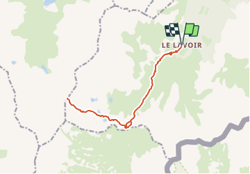
Trail Walking of 15.5 km to be discovered at Auvergne-Rhône-Alpes, Savoy, Modane. This trail is proposed by geoffrayLayeux.
Positioning
Country:
France
Region :
Auvergne-Rhône-Alpes
Department/Province :
Savoy
Municipality :
Modane
Location:
Unknown
Start:(Dec)
Start:(UTM)
314071 ; 5002267 (32T) N.
Comments